![[UK map]](/img/locationmap.png)
| OSGB36 trig archive spreadsheet - IW | |||||||||||||
|---|---|---|---|---|---|---|---|---|---|---|---|---|---|
| Trig Name | Original Name | New Name | EASTING | NORTHING | HEIGHT | ORDER | TYPE OF MARK | Computing Date | CLASS OF LEVELLING | Date of Levelling | LEVELLING DATUM | DESTROYED MARK INDICATOR | COMMENTS |
| Fort Hubberston | SN02/T58 | SN02T058 | 189095.52 | 205558.54 | 0.000 | 4 | BLOCK | 01/06/1966 | 0 | 0 |
Nearby trigpoints, placenames
There are 5 photos for this trigpoint (view album).
This trigpoint:
Is ranked joint 17864th with 92 other trigs (more).
Has a mean score of 4.20/10 (from 5 logged visits)
Was First logged: 28th Apr 2013
Has never been found intact
Was Last logged: 23rd Nov 2022
Of the 5 logged visits,
1 recorded a location
The error was 0m
You are not logged in. You must login if you wish to log a visit.
Selection of photos for this Surface Block. By Seth7,CLJ &RLJ  ©jonglew 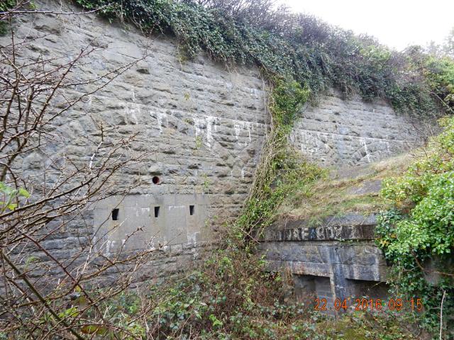 ©jonglew 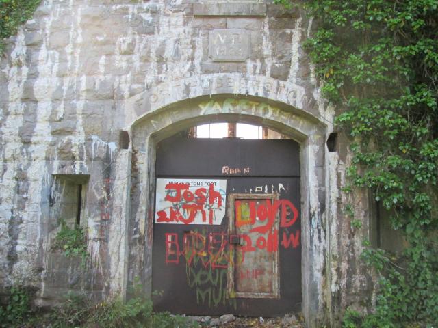 By Dusty  By Dusty |
![]() 23rd Nov 2022 17:16 by Seth7,CLJ &RLJ
23rd Nov 2022 17:16 by Seth7,CLJ &RLJ
FB Number: Not logged Condition: Inaccessible Score: 5/10
Access restricted. According to site for refurbishment. Parked up at end of track in housing estate. recently saw documentary on this place which has been bought by a private owner who is slowly clearing and restoring the place.
![]()
![]() 22nd Apr 2016 09:16 by jonglew
22nd Apr 2016 09:16 by jonglew
FB Number: Not logged Condition: Inaccessible Score: 3/10
Accessed from end of road by school. Over field gate and follow path to fort entrance which is securely padlocked. Surface Block is located on the upper section outwith the fort but dense impenetrable scrub makes access impossible.
![]() Fort Entrance TP11618©jonglew
Fort Entrance TP11618©jonglew![]() SB at top of this wall TP11618©jonglew
SB at top of this wall TP11618©jonglew
![]() 29th Jan 2015 15:25 by Ant1974
29th Jan 2015 15:25 by Ant1974
FB Number: Not logged Condition: Inaccessible Score: 5/10
![]() 5th Jun 2014 09:45 by Dusty
5th Jun 2014 09:45 by Dusty
FB Number: Not logged Condition: Inaccessible Score: 5/10
Fort is inaccessible. Area around is thick scrub.
![]() 28th Apr 2013 08:39 by peregrinus
28th Apr 2013 08:39 by peregrinus
Gridref: SM 89100 05562 FB Number: Not logged Condition: Not Logged Score: 3/10
Old fort, access apparently via Port Authority, didn't investigate further. SN02/T58 Block
![[map]](/img/trig-map.png.php?t=11618&b=2&l=0&)