![[UK map]](/img/locationmap.png)
| OSGB36 trig archive spreadsheet - IW | |||||||||||||
|---|---|---|---|---|---|---|---|---|---|---|---|---|---|
| Trig Name | Original Name | New Name | EASTING | NORTHING | HEIGHT | ORDER | TYPE OF MARK | Computing Date | CLASS OF LEVELLING | Date of Levelling | LEVELLING DATUM | DESTROYED MARK INDICATOR | COMMENTS |
| Forfar Meml Twr | NO46/T5 | NO46T005 | 345762.42 | 749317.08 | 0.000 | 3 | BOLT | 01/06/1956 | 0 | 0 | |||
| Forfar Meml Twr | NO46/T5 | NO46T005 | 345763.23 | 749317.53 | 0.000 | 3 | CENTRE | 01/06/1956 | 0 | 0 | |||
| Forfar Meml Twr Turret | NO46/T5 | NO46T005 | 345764.41 | 749319.79 | 0.000 | 3 | CENTRE | 01/06/1956 | 0 | 0 | TURRET CENTRE |
Nearby trigpoints, placenames
There are 3 photos for this trigpoint (view album).
This trigpoint:
Is ranked joint 6022nd with 170 other trigs (more).
Has a mean score of 5.50/10 (from 4 logged visits)
Was First logged: 28th Oct 2016
Has never been found intact
Was Last logged: 27th Oct 2020
Of the 4 logged visits,
1 recorded a location
The error was 12m
You are not logged in. You must login if you wish to log a visit.
![]() 27th Oct 2020 11:30 by Wubbleyew
27th Oct 2020 11:30 by Wubbleyew
FB Number: Not logged Condition: Inaccessible Score: 7/10
Fine little walk up to this viewpoint on Balmashanner Hill overlooking Forfar, the Valley Of Strathmore, and the Braes Of Angus. The War Memorial was officially opened on 11th September 1921 by Queen Mary (bet she didnt walk up here). Beautiful autumn colours.
![]() 5th May 2020 05:50 by scotti
5th May 2020 05:50 by scotti
FB Number: Not logged Condition: Inaccessible Score: 5/10
![]() 8th Jun 2019 08:52 by peregrinus
8th Jun 2019 08:52 by peregrinus
FB Number: Not logged Condition: Inaccessible Score: 5/10
Locked, no info posted on opening times. Tump summit
![]() 28th Oct 2016 14:50 by scotti
28th Oct 2016 14:50 by scotti
Gridref: NO 45773 49323 FB Number: Not logged Condition: Inaccessible Score: 5/10
Built in 1921 to commemorate the fallen of the First World War this monument sits prominently above the town on Balmashanner Hill (locally Bummie). Unfortunately the tower is locked and only open on occasional special days.
![]() From the path
From the path ![]() Looking up from the town
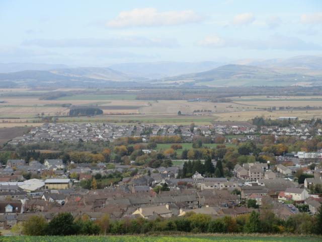
Looking up from the town ![]() View from near the tower This is the view looking slightly west of north over Forfar and Strathmore towards the Grampians with a hazy Glen Clova straight ahead.
View from near the tower This is the view looking slightly west of north over Forfar and Strathmore towards the Grampians with a hazy Glen Clova straight ahead.
![[map]](/img/trig-map.png.php?t=15618&b=2&l=0&)