![[UK map]](/img/locationmap.png)
| OSGB36 trig archive spreadsheet - IW | |||||||||||||
|---|---|---|---|---|---|---|---|---|---|---|---|---|---|
| Trig Name | Original Name | New Name | EASTING | NORTHING | HEIGHT | ORDER | TYPE OF MARK | Computing Date | CLASS OF LEVELLING | Date of Levelling | LEVELLING DATUM | DESTROYED MARK INDICATOR | COMMENTS |
| North Moor | SE38/T68 | SE38T068 | 435932.88 | 495474.58 | 0.000 | 3 | BLOCK | 01/06/1955 | 0 | 1 | Dest 04/75 |
Nearby trigpoints, placenames
There is 1 photo for this trigpoint (view album).
This trigpoint:
Is ranked joint 24560th with 10 other trigs (more).
Has a mean score of 1.00/10 (from 3 logged visits)
Was First logged: 20th Sep 2014
Has never been found intact
Was Last logged: 13th Nov 2019
Of the 3 logged visits,
1 recorded a location
The error was 0m
You are not logged in. You must login if you wish to log a visit.
Selection of photos for this Block.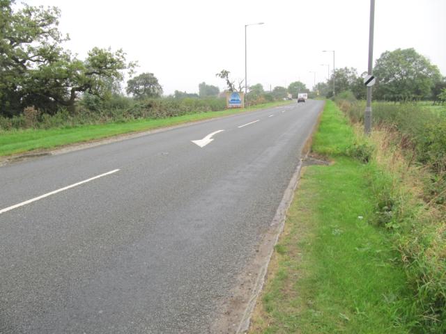 By ted |
![]() 13th Nov 2019 10:05 by Border Peat
13th Nov 2019 10:05 by Border Peat
Gridref: SE 35932 95474 FB Number: Not logged Condition: Destroyed Score: 0/10
![]() 8th Apr 2016 13:24 by Ant1974
8th Apr 2016 13:24 by Ant1974
FB Number: Not logged Condition: Destroyed Score: 3/10
![]() 20th Sep 2014 08:15 by ted
20th Sep 2014 08:15 by ted
FB Number: Not logged Condition: Destroyed Score: 0/10
Block destroyed (OS 04/75). Verge on W side of road,
![]() North Moor site
North Moor site
![[map]](/img/trig-map.png.php?t=17485&b=2&l=0&)