![[UK map]](/img/locationmap.png)
| OSGB36 trig archive spreadsheet - IW | |||||||||||||
|---|---|---|---|---|---|---|---|---|---|---|---|---|---|
| Trig Name | Original Name | New Name | EASTING | NORTHING | HEIGHT | ORDER | TYPE OF MARK | Computing Date | CLASS OF LEVELLING | Date of Levelling | LEVELLING DATUM | DESTROYED MARK INDICATOR | COMMENTS |
| Harwood Side | NY86/T30 | NY86T030 | 386742.49 | 551447.13 | 489.204 | 3 | PILLAR | 01/06/1953 | 2 | 01/06/1953 | N | 0 |
Nearby trigpoints, placenames
There are 27 photos for this trigpoint (view album).
This trigpoint:
Is ranked joint 3020th with 46 other trigs (more).
Has a mean score of 6.14/10 (from 35 logged visits)
Was First logged: 1st Jul 1999
Was Last found intact: 18th Jun 2022
Was Last logged: 18th Jun 2023
Of the 35 logged visits,
7 recorded a location and of these....
All were within 4m
The average error was 1m
The closest was 1m
You are not logged in. You must login if you wish to log a visit.
Selection of photos for this Pillar. By Reynard  By Peter Astle  By NJM  By CJO  By ted 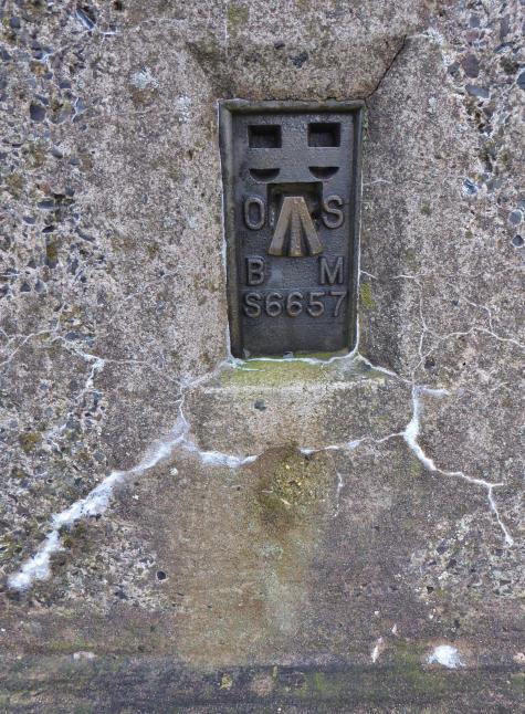 By Aye Jimmy  By clochandighter By Bambi&Thumper See 19 more in the album. |
![]() 18th Jun 2023 00:00 by Llondon
18th Jun 2023 00:00 by Llondon
FB Number: Not logged Condition: Not Logged Score: 8/10
![]() 23rd Apr 2023 09:57 by matty1971b
23rd Apr 2023 09:57 by matty1971b
FB Number: S6657 Condition: Not Logged Score: 6/10
Long Drag track from near Ellershope Bridge in Spartylea, parking for a couple of cars, then turn off on track to right to summit area. Then went across to Harwood Side Trig Point, nice views on a clear day
![]() 5th Feb 2023 17:51 by blackboot29
5th Feb 2023 17:51 by blackboot29
FB Number: Not logged Condition: Not Logged Score: 5/10
Parked on Allendale Rd.and followed bridle way up to the track. A bit of heather bashing needed for the last half mile. Not an easy one as rough underfoot .
![]() 18th Jun 2022 14:15 by Reynard
18th Jun 2022 14:15 by Reynard
FB Number: S6657 Condition: Good Score: 7/10
Parked in Spartylea and followed the bridleway up to Sinderhope Carrs. Good path most of the way, but had to cut across heather and bog for the last few hundred metres. Dry today, but probably pretty wet in winter. Good long views
![]() 19th May 2022 11:35 by Peter Astle
19th May 2022 11:35 by Peter Astle
FB Number: S6657 Condition: Slightly damaged Score: 6/10
![]()
![]() 19th Mar 2022 17:10 by painterman61
19th Mar 2022 17:10 by painterman61
FB Number: S6657 Condition: Good Score: 7/10
Walked up on a good track from Spartylea, last bit across rough moor. Trig has a crack around the middle above the fb no plug good views to North and east sunny but a freezing cold wind.
![]() 13th Nov 2021 10:55 by rupertal
13th Nov 2021 10:55 by rupertal
FB Number: Not logged Condition: Good Score: 6/10
![]() 9th Oct 2021 16:33 by Weathaz
9th Oct 2021 16:33 by Weathaz
FB Number: Not logged Condition: Not Logged Score: 5/10
![]() 8th Apr 2021 14:16 by 2510chris
8th Apr 2021 14:16 by 2510chris
FB Number: Not logged Condition: Good Score: 6/10
Walked from allenheads via green hill & Linswood Moor
![]() 20th Dec 2020 11:43 by NJM
20th Dec 2020 11:43 by NJM
FB Number: S6657 Condition: Good Score: 7/10
My second visit, different route. Parked at King's Law and followed the bridle path SW to Watsons Pike TP. We then followed the track down Hangman Hill past Grouse Butts for Grouse Slaughtering Buttheads and continued W and then S passing under Sinderhope Carrs. There's any number of Curricks along the top of the Carrs, but beyond this the moor is a fairly flat and featureless plateau. We made our way across the moor to its highest point, which might not be obvious if the visibility is poor. On a cold and mostly overcast day the views were surprisingly good, with patches of Northumberland illuminated by flashes of sunlight. We then continued NE across the moor to the new Shooting Lodge above Ladle Well, returning to King's Law via 'Long Drag', the track that runs N alongside the Linn Burn (blithely ignoring the many notices along the length of the track that it is not a PROW...)
![]() View West Storm's TP #160
View West Storm's TP #160
![]() 29th Nov 2020 13:31 by CJO
29th Nov 2020 13:31 by CJO
Gridref: NY 86740 51447 FB Number: S6657 Condition: Slightly damaged Score: 6/10
Cap missing. Has hairline cracks and spalling around spider. Thick mist. Had to rely on compass. Still no one seen.
![]() Pillar in thick mist
Pillar in thick mist
![]() 23rd Nov 2020 00:00 by carolje
23rd Nov 2020 00:00 by carolje
FB Number: Not logged Condition: Slightly damaged Score: 5/10
![]() 30th May 2020 18:10 by Geordie
30th May 2020 18:10 by Geordie
FB Number: Not logged Condition: Not Logged Score: 5/10
![]() 7th Oct 2019 11:26 by MrHappy
7th Oct 2019 11:26 by MrHappy
FB Number: S6657 Condition: Not Logged Score: 5/10
![]() 13th Oct 2018 13:00 by nichex
13th Oct 2018 13:00 by nichex
FB Number: S6657 Condition: Slightly damaged Score: 5/10
![]() 5th Jul 2018 14:28 by Nick&Rosie
5th Jul 2018 14:28 by Nick&Rosie
FB Number: S6657 Condition: Good Score: 7/10
Always felt slightly guilty that almost all of the Northumberland TP's I've bagged have been done by a car journey between each 'bag', today we did 4 in a single 8 hour round...Green Hill - Harwood Side - Watsons Pike - Bulbeck Common - Green Hill (again)...From Green Hill continued E then N along the bulldozed track, past the Shooting Cabins (you get to realise on Allendale Common that grouse slaughtering is less of a past-time, more like 'Heavy Industry'). Further N from the cabins a gate is reached, and we followed the rough track ahead NE before cutting up N from the Nevin Sike across the moor to a cairn we'd stupidly believed to be the TP...this resulted in a more substantial yomp NW over rough moorland to the TP, recommend taking the track just before the gate W then NW and then cutting N over to the TP from the currick at P502. Good 360 views, albeit hazy on the day. Then off to Watsons Pike for the 3rd of 4 TPs today - a long and arduous trip, but immensely satisfying!
![]() View North
View North ![]() View East
View East ![]() View South
View South ![]() View West
View West
![]() 29th Jan 2018 14:00 by beckroad
29th Jan 2018 14:00 by beckroad
FB Number: S6657 Condition: Slightly damaged Score: 7/10
Parked on roadside near Sipton Shield. A 2hr brisk winter walk exploring Sipton Cleugh. The fabulous panoramic views of Killhope, Cheviot and Simonside are well worth the Long Drag to reach this trig point. Evidence of cracking across middle section of trig point. A smaller crack is just above the flush bracket.
![]() 11th Nov 2017 12:55 by ted
11th Nov 2017 12:55 by ted
FB Number: S6657 Condition: Good Score: 7/10
Plug missing, slight damage to top; crack around pillar not too serious. Soggy moorland and burnt heather once off the track. Good views over Allendale and the Tyne valley.
![]() Harwood Side trig
Harwood Side trig![]() Harwood Side trig
Harwood Side trig![]() Harwood Side FB
Harwood Side FB![]() Harwood Side top
Harwood Side top
![]() 29th Mar 2017 00:00 by caroleengel
29th Mar 2017 00:00 by caroleengel
Gridref: NY 86742 51446 FB Number: Not logged Condition: Good Score: 5/10
![]() 24th Oct 2016 13:00 by ger
24th Oct 2016 13:00 by ger
FB Number: S6657 Condition: Good Score: 5/10
![]() 12th May 2016 17:27 by paulxtr
12th May 2016 17:27 by paulxtr
FB Number: S6657 Condition: Good Score: 5/10
From Watsons Pike across rough ground. Returned the same way. Not a recommended route.
![]() Harwood Side ©paulxtr
Harwood Side ©paulxtr
![]() 23rd Jan 2016 12:35 by Aye Jimmy
23rd Jan 2016 12:35 by Aye Jimmy
Gridref: NY 86742 51448 FB Number: S6657 Condition: Slightly damaged Score: 5/10
No cap, horizontal hairline cracks, slight damage to top. One sight hole open.
![]() Harwood Side The trig.
Harwood Side The trig.![]() Harwood Side Top of trig.
Harwood Side Top of trig.![]() Harwood Side The FB.
Harwood Side The FB.
![]() 2nd Nov 2012 17:18 by peebs
2nd Nov 2012 17:18 by peebs
FB Number: S6657 Condition: Not Logged Score: 5/10
![]() 20th Mar 2011 15:10 by sheepsocks
20th Mar 2011 15:10 by sheepsocks
FB Number: S6657 Condition: Slightly damaged Score: 5/10
Parked on roadside verge near Sinderhope Lodge and walked up via bridleway and access land. A bit boggy in places. Another North Pennine trig on a flat-topped summit in a sea of heather. On our descent met by man from Sinderhope Lodge who objected to us parking anywhere along the public road along the valley (though conceding that we did have the right to walk along the road/bridleway) Its not as though we had parked outside his house. He obviously has delusions that the public road is his private drive.
![]()
![]()
![]() 31st Dec 2010 11:55 by staggie34
31st Dec 2010 11:55 by staggie34
FB Number: Not logged Condition: Slightly damaged Score: 7/10
Good viewpoint but not great today due to some low cloud. Had to stomp accross some burnt heather to get to this but was easier than last time. Repeat of 2008 route. Trig has a few cracks.
![]() 24th Jul 2010 14:11 by senrabyar
24th Jul 2010 14:11 by senrabyar
Gridref: NY 86742 51445 FB Number: S6657 Condition: Slightly damaged Score: 5/10
Slightly damaged because there is a crack around the whole pillar, and the top screed is beginning to crumble. Dry summer? Still wet up here!
![]() 22nd May 2010 13:28 by coinea
22nd May 2010 13:28 by coinea
Gridref: NY 86742 51445 FB Number: S6657 Condition: Slightly damaged Score: 7/10
![]() 22nd May 2010 13:20 by clochandighter
22nd May 2010 13:20 by clochandighter
Gridref: NY 86741 51447 FB Number: S6657 Condition: Slightly damaged Score: 7/10
Tertiary station pillar completed 21st September 1951 costing £22.9s.6d. Column damaged with horizontal crack above FB. Spider centre open. Flush bracket faces 286° WNW. Vented through SW sight hole. Photographed 22/05/2010, GRP.
![]() S6657 - Harwood Side & GRP
S6657 - Harwood Side & GRP![]() S6657 - Harwood Side pillar & FB
S6657 - Harwood Side pillar & FB
![]() 10th Jul 2008 12:41 by staggie34
10th Jul 2008 12:41 by staggie34
FB Number: S6657 Condition: Good Score: 6/10
Bagged this on a circular walk up from Spartylea via the Green Hill trig, weather showery. After I passed the two little shooting cabins, I took the track going off to the left just before the gate where the public bridleway leaves the track. I don't think the track I took is on the OS maps but it takes you closer to the trig than anything else. This area is all access land too. The ground was a bit damp when I left the track to head for the visible trig but not too bad. Onto Watsons Pike after this.
![]() Harwood Side ©staggie34
Harwood Side ©staggie34
![]() 7th May 2007 15:30 by Bambi&Thumper
7th May 2007 15:30 by Bambi&Thumper
Gridref: NY 86745 51444 FB Number: S6657 Condition: Good Score: 8/10
Found at: N 54° 51.457 W 002° 12.480
![]() The Trigpoint on Harwood Side
The Trigpoint on Harwood Side ![]() Thumper and the view from near Harwood Side
Thumper and the view from near Harwood Side
![]() 3rd Jul 2005 12:00 by peregrinus
3rd Jul 2005 12:00 by peregrinus
FB Number: S6657 Condition: Slightly damaged Score: 6/10
metal cap deep letters, pillar crazed with crack around trig just above FB height, heather summit, OK view
![]() Montaged by Jon Rouse ©peregrinus
Montaged by Jon Rouse ©peregrinus
![]() 29th May 2005 10:30 by Shacklesborough
29th May 2005 10:30 by Shacklesborough
FB Number: S6657 Condition: Good Score: 8/10
Nice views all round, but especially to the north and east.
![]()
![]() 2nd May 2005 11:30 by Walker Dan
2nd May 2005 11:30 by Walker Dan
FB Number: S6657 Condition: Good Score: 9/10
Another trig point in a sea of heather. The last half mile or so which ever way you come off piste but great views in all directions.
![]() Trig point and beyond Looking towards Killhope Law and Cross Fell©Walker Dan
Trig point and beyond Looking towards Killhope Law and Cross Fell©Walker Dan
![]() 12th May 2000 14:43 by jimmy
12th May 2000 14:43 by jimmy
FB Number: S6657 Condition: Good Score: 5/10
![]() 1st Jul 1999 00:00 by mickandshane
1st Jul 1999 00:00 by mickandshane
FB Number: S6657 Condition: Good Score: 7/10
Plug with heavily indented lettering.
![[map]](/img/trig-map.png.php?t=3661&b=2&l=0&)