![[UK map]](/img/locationmap.png)
| OSGB36 trig archive spreadsheet - IW | |||||||||||||
|---|---|---|---|---|---|---|---|---|---|---|---|---|---|
| Trig Name | Original Name | New Name | EASTING | NORTHING | HEIGHT | ORDER | TYPE OF MARK | Computing Date | CLASS OF LEVELLING | Date of Levelling | LEVELLING DATUM | DESTROYED MARK INDICATOR | COMMENTS |
| New Cowper | NY11/T39 | NY11T039 | 311815.34 | 545962.05 | 38.304 | 3 | PILLAR | 01/06/1952 | 1 | 01/06/1971 | N | 1 | Destroyed 07/91 |
Nearby trigpoints, placenames
There are 9 photos for this trigpoint (view album).
This trigpoint:
Is ranked joint 23878th with 50 other trigs (more).
Has a mean score of 2.57/10 (from 21 logged visits)
Was First logged: 22nd Nov 2003
Has never been found intact
Was Last logged: 4th Jul 2023
Of the 21 logged visits,
3 recorded a location and of these....
All were within 63m
The average error was 42m
1 was exact
You are not logged in. You must login if you wish to log a visit.
| Selection of photos for this Pillar. ©Mark-UKUS 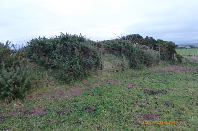 ©jonglew  By Keith Stevens  By CJO  By clochandighter  By iainmac See 3 more in the album. |
![]() 4th Jul 2023 15:34 by Mark-UKUS
4th Jul 2023 15:34 by Mark-UKUS
FB Number: Not logged Condition: Destroyed Score: 5/10
The third bag of the day on the Cumbrian Coast avoiding the rain falling on the Lakeland Fells. Nothing much to see, simply parked at the right hand bend on the Bridleway to the west and walked along the quarry path. Stopped at the point of the long lost pillar, had a look around, took a screen shot of the spot on my OS App and returned to the car.
![]() ©Mark-UKUS
©Mark-UKUS
![]() 4th Mar 2022 14:30 by dugswell2
4th Mar 2022 14:30 by dugswell2
FB Number: Not logged Condition: Destroyed Score: 5/10
Long gone.
![]() 5th Feb 2022 16:12 by A1Mushroom
5th Feb 2022 16:12 by A1Mushroom
FB Number: S5774 Condition: Destroyed Score: 5/10
Long gone.
![]() 22nd May 2021 14:30 by Mickandkim
22nd May 2021 14:30 by Mickandkim
Gridref: NY 11800 45900 FB Number: S5774 Condition: Destroyed Score: 1/10
Gone
![]() 26th Mar 2018 18:45 by Dusty
26th Mar 2018 18:45 by Dusty
FB Number: Not logged Condition: Destroyed Score: 4/10
On return I spotted farmer in field with cattle. wandered over to ask about pillar. He new nothing and was only a farm hand.
![]() 14th Dec 2017 14:23 by jonglew
14th Dec 2017 14:23 by jonglew
FB Number: Not logged Condition: Destroyed Score: 5/10
Was located somewhere within first 10m of a raised field boundary, odd this one's gone, but no sign of it anywhere and OS record is as destroyed July 1991. So gone it is.
![]() Would have been somewhere along this gorsey field bdy TP5091©jonglew
Would have been somewhere along this gorsey field bdy TP5091©jonglew
![]() 8th Aug 2017 18:20 by weekender
8th Aug 2017 18:20 by weekender
FB Number: Not logged Condition: Destroyed Score: 3/10
![]() 11th Nov 2016 13:00 by Moacky
11th Nov 2016 13:00 by Moacky
FB Number: Not logged Condition: Destroyed Score: 3/10
GPS was pointing into hedge just inside gate - no trig!
![]() 6th Nov 2014 14:54 by Keith Stevens
6th Nov 2014 14:54 by Keith Stevens
FB Number: Not logged Condition: Destroyed Score: 3/10
Gone in 1991. Was obviously in the hedge, raised up
![]() 5th Oct 2014 12:27 by peregrinus
5th Oct 2014 12:27 by peregrinus
FB Number: Not logged Condition: Possibly missing Score: 5/10
gps puts it in se corner of field not on track. poss buried in hedgebank but I doubt it. gps elev matches os elev for trig 39m so I doubt the area has been quarried and reinstated. 1991 os destruction date coincides with when they offered to remove a number of farm trigs when the farmer wished it, so I've been told
![]() 21st Jul 2012 13:22 by CJO
21st Jul 2012 13:22 by CJO
FB Number: Not logged Condition: Destroyed Score: 3/10
location is on access track to quarry workings
![]() 10th Apr 2012 18:52 by PeteBoggs
10th Apr 2012 18:52 by PeteBoggs
FB Number: Not logged Condition: Destroyed Score: 1/10
Lost to quarry
![]() 9th Apr 2011 19:25 by Border Peat
9th Apr 2011 19:25 by Border Peat
Gridref: NY 11815 45962 FB Number: Not logged Condition: Destroyed Score: 6/10
![]() And another one bits the dust S5774©Border Peat
And another one bits the dust S5774©Border Peat
![]() 22nd Oct 2010 14:22 by Marramintar
22nd Oct 2010 14:22 by Marramintar
Gridref: NY 11800 45900 FB Number: Not logged Condition: Destroyed Score: 0/10
unfortunately the quarrying seems to have swallowed this trig :-(
![]() 13th Jun 2009 17:53 by coinea
13th Jun 2009 17:53 by coinea
FB Number: S5774 Condition: Destroyed Score: 0/10
![]() 13th Jun 2009 17:52 by clochandighter
13th Jun 2009 17:52 by clochandighter
FB Number: S5774 Condition: Destroyed Score: 0/10
This demise was unnecessary. GPS lead me to a spot beside the hedgeline which was not engulfed by the dirt track. Built 11/49, destroyed 7/91 (LVP@OS). Rogue farmer or landowner suspected.
![]() GPS locate GRP marks the spot
GPS locate GRP marks the spot![]() S5774 - New Cowper OS Map, 1:2500, 1969.
S5774 - New Cowper OS Map, 1:2500, 1969.
![]() 24th May 2008 10:25 by Bergfuehrer
24th May 2008 10:25 by Bergfuehrer
FB Number: Not logged Condition: Destroyed Score: 0/10
Cumberland.
![]() 21st Oct 2006 12:45 by chrisbombington
21st Oct 2006 12:45 by chrisbombington
FB Number: Not logged Condition: Destroyed Score: 0/10
non Trig
![]() 1st May 2005 12:00 by iainmac
1st May 2005 12:00 by iainmac
FB Number: Not logged Condition: Destroyed Score: 0/10
I suspect sand quarrying may have removed the top of this hill.
![]()
![]() 22nd Mar 2005 13:15 by mickandshane
22nd Mar 2005 13:15 by mickandshane
FB Number: Not logged Condition: Destroyed Score: 3/10
We parked at the sharp corner and walked towards the trig. Some archaeologists were carrying out a dig in the first field. The hedgeline where the trig was is still there and has not been engulfed by the sand quarry yet so there's no real reason why it should have been destroyed. It's definiteley not there though, as a load of cows and calves will testify - the inhabitants of the field.
![]() 22nd Nov 2003 14:30 by lepustimidus
22nd Nov 2003 14:30 by lepustimidus
FB Number: Not logged Condition: Destroyed Score: 2/10
Trig point missing. (Destroyed 7/91. No. was 5774 - GRP Trigonomy)
![[map]](/img/trig-map.png.php?t=5091&b=2&l=0&)