![[UK map]](/img/locationmap.png)
| OSGB36 trig archive spreadsheet - IW | |||||||||||||
|---|---|---|---|---|---|---|---|---|---|---|---|---|---|
| Trig Name | Original Name | New Name | EASTING | NORTHING | HEIGHT | ORDER | TYPE OF MARK | Computing Date | CLASS OF LEVELLING | Date of Levelling | LEVELLING DATUM | DESTROYED MARK INDICATOR | COMMENTS |
| Shirecliffe Gunsite | SK39/T58 | SK39T058 | 434975.95 | 389675.93 | 174.732 | 3 | BLOCK | 01/06/1948 | 1 | 01/04/1961 | N | 1 | Pillar replacement 08/67 Dest 03/73 |
| Shirecliffe Gunsite | SK39/T58 | SK39T058 | 434975.95 | 389675.93 | 174.732 | 3 | PILLAR | 01/06/1948 | 1 | 01/04/1961 | N | 1 | Dest 3/67 |
Nearby trigpoints, placenames
There are 20 photos for this trigpoint (view album).
This trigpoint:
Is ranked joint 21750th with 121 other trigs (more).
Has a mean score of 3.46/10 (from 39 logged visits)
Was First logged: 13th Jan 2003
Has never been found intact
Was Last logged: 15th Dec 2023
Of the 39 logged visits,
5 recorded a location and of these....
All were within 461m
The average error was 135m
2 were exact
You are not logged in. You must login if you wish to log a visit.
Selection of photos for this Pillar. By JoeNTMY  ©Pritch227 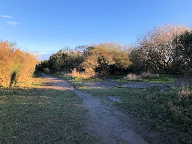 By Wheresthatpenguin  ©Duncan68  By haighr01 See 15 more in the album. |
![]() 15th Dec 2023 11:32 by JoeNTMY
15th Dec 2023 11:32 by JoeNTMY
FB Number: Not logged Condition: Destroyed Score: 4/10
Long gone
![]()
![]() 20th Jul 2023 14:34 by mralrule
20th Jul 2023 14:34 by mralrule
FB Number: Not logged Condition: Destroyed Score: 1/10
Gone nothing more to add
![]() 15th Apr 2023 17:47 by Earby Rambler
15th Apr 2023 17:47 by Earby Rambler
FB Number: Not logged Condition: Destroyed Score: 1/10
Visited whilst on day out with Painterman61.
![]() 15th Apr 2023 17:47 by painterman61
15th Apr 2023 17:47 by painterman61
FB Number: Not logged Condition: Destroyed Score: 1/10
Revisit
![]() 10th Mar 2023 17:00 by Pritch227
10th Mar 2023 17:00 by Pritch227
FB Number: Not logged Condition: Destroyed Score: 5/10
gone.....
![]() ©Pritch227
©Pritch227
![]() 10th Mar 2023 17:00 by WuzzerL
10th Mar 2023 17:00 by WuzzerL
FB Number: Not logged Condition: Destroyed Score: 3/10
![]() 12th Feb 2022 12:30 by Mickandkim
12th Feb 2022 12:30 by Mickandkim
Gridref: SK 34900 89600 FB Number: S4137 Condition: Destroyed Score: 1/10
Gone
![]() 16th Jan 2022 09:45 by Wheresthatpenguin
16th Jan 2022 09:45 by Wheresthatpenguin
Gridref: SK 34976 89676 FB Number: S4137 Condition: Destroyed Score: 1/10
Gone. Destroyed March 1967
![]() 8th Dec 2021 10:41 by Duncan68
8th Dec 2021 10:41 by Duncan68
FB Number: Not logged Condition: Destroyed Score: 1/10
No sign of pillar although ther is some unusual metal and stone remains near by possibly from anti aircraft guns
![]() ©Duncan68
©Duncan68
![]() 4th Mar 2021 11:30 by Bert
4th Mar 2021 11:30 by Bert
FB Number: Not logged Condition: Destroyed Score: 5/10
![]() 15th Feb 2020 00:00 by Ronaldo333
15th Feb 2020 00:00 by Ronaldo333
FB Number: Not logged Condition: Not Logged Score: 5/10
![]() 5th Aug 2019 13:10 by Cootking
5th Aug 2019 13:10 by Cootking
FB Number: Not logged Condition: Destroyed Score: 5/10
Gone
![]() 21st Jul 2019 06:44 by eon
21st Jul 2019 06:44 by eon
FB Number: Not logged Condition: Destroyed Score: 2/10
(1464) Parked up at Standish Bank, and from there it was a short walk to the location. 3 for 1 trigs at this spot. Also nearby is a rivet, and not far from where I parked is another trig-point. Not a bad haul! Pillars long gone, though. Cracking views to be had of Sheffield.
![]() Shirecliffe Gunsite. ©eon
Shirecliffe Gunsite. ©eon
![]() 20th Dec 2017 11:55 by haighr01
20th Dec 2017 11:55 by haighr01
FB Number: Not logged Condition: Destroyed Score: 5/10
As with Wincobank Hill, I felt the need to ascend from the Don so parked at Aldi on the A61. Rutland Road is steep, but eventually a public footpath comes off left and I kept taking the higher paths, the mast is a good guide, keeping a football pitch to my right. Although there was no pillar to be found this is a most interesting area and worth a visit anyway for the gunsite, two areas, and the views over the Sheffield skyline and beyond. Greno Knoll, Birley Edge, Loxley Common all easily visible if you know those trigs. And the Don Valley over Hillsborough. Sheffield has a complex geography which through this hobby I am learning so much more.
![]() Sheffield, South Yorkshire City Skyline
Sheffield, South Yorkshire City Skyline![]() Yorkshire Defence Greno Knoll, centre, Don Valley centre left
Yorkshire Defence Greno Knoll, centre, Don Valley centre left![]() Shirecliffe Gunsite The bagging area
Shirecliffe Gunsite The bagging area
![]() 25th Oct 2017 19:45 by weekender
25th Oct 2017 19:45 by weekender
FB Number: Not logged Condition: Destroyed Score: 5/10
![]() 27th Aug 2017 23:58 by Ant1974
27th Aug 2017 23:58 by Ant1974
FB Number: Not logged Condition: Destroyed Score: 5/10
![]() 22nd Aug 2017 11:45 by robinhood
22nd Aug 2017 11:45 by robinhood
FB Number: Not logged Condition: Destroyed Score: 6/10
I've been wanting to visit this trig site and the ridge it's on for years. I finally got there today as my mate, Nobby, suggested this walk instead of the more picturesque moors W of Sheffield. No trig, but the base of a WW2 AA gun site is still there as are the remains of a bandstand where we had lunch and a beer. lt was built, I was told, by trainee bricklayers from the nearby (but now closed) college. The landfill site below the edge is now being covered over, eventually with vegetation. Views of industry, housing, fields an moors in the distance.
![]() 6th Jun 2017 12:14 by Griefmiester
6th Jun 2017 12:14 by Griefmiester
FB Number: Not logged Condition: Destroyed Score: 5/10
No pillars but worth a look :)
![]()
![]() 29th Apr 2017 00:00 by dogwalking
29th Apr 2017 00:00 by dogwalking
Gridref: SK 34900 89600 FB Number: Not logged Condition: Destroyed Score: 3/10
gone nice views
![]() 5th Feb 2017 13:41 by dugswell2
5th Feb 2017 13:41 by dugswell2
FB Number: GONE Condition: Destroyed Score: 3/10
I skied near here in the early 1990s. Parked on the road then an easy amble up the sloping football pitch.
![]() 17th Dec 2016 08:22 by painterman61
17th Dec 2016 08:22 by painterman61
FB Number: S4137 Condition: Destroyed Score: 5/10
Easy walk up from main road long gone
![]() site ©painterman61
site ©painterman61![]() gunsite ©painterman61
gunsite ©painterman61
![]() 27th Oct 2016 00:00 by rupertal
27th Oct 2016 00:00 by rupertal
FB Number: Not logged Condition: Destroyed Score: 5/10
![]() 17th May 2016 12:00 by ThomasPenn
17th May 2016 12:00 by ThomasPenn
FB Number: Not logged Condition: Destroyed Score: 7/10
Great views, no pillar though
![]() 17th Jul 2015 12:48 by trigging on an island
17th Jul 2015 12:48 by trigging on an island
FB Number: Not logged Condition: Destroyed Score: 3/10
3 for the price of 1 bargain here was enough to tip me over the 700 pillars mark at the end of this particular bagging spree
![]() 11th Feb 2015 15:43 by pkbathrooms
11th Feb 2015 15:43 by pkbathrooms
Gridref: SK 34976 89676 FB Number: S4137 Condition: Destroyed Score: 5/10
all gone.
![]()
![]() 11th Jan 2015 14:29 by Father Ted
11th Jan 2015 14:29 by Father Ted
FB Number: Not logged Condition: Destroyed Score: 3/10
Police are on the look our for a garden containing three ex-trig pillars. A very blustery day up here today with wife, son and dog.
![]() 3rd Aug 2014 14:43 by CJO
3rd Aug 2014 14:43 by CJO
FB Number: Not logged Condition: Destroyed Score: 5/10
Gunsite remains but no pillar or its BLOCK replacement.
![]() 18th Dec 2011 10:00 by peregrinus
18th Dec 2011 10:00 by peregrinus
FB Number: Not logged Condition: Destroyed Score: 5/10
According to www.bench-marks.org.uk, the FB was initially S4137, is recorded as having been replaced by S6755, and then later by a reused unprefixed FB _2732. The location SK 34976 89676 is on or close to the footpath, an area of rocky slabs, no sign of concrete base or bolt, a few metres NW of the large gun emplacement base. I made a half-hearted search of the bushes but nothing concrete found...
![]() Trig would have been in foreground
Trig would have been in foreground ![]() Gunsite base with trig site in background
Gunsite base with trig site in background
![]() 3rd May 2011 14:45 by MAC.HAWK
3rd May 2011 14:45 by MAC.HAWK
FB Number: Not logged Condition: Destroyed Score: 4/10
Number 4 of the day. Fabulous view of the landfill site but a somewhat more extensive urban view over the rest of the city. NCOF.
![]() 21st Mar 2011 10:30 by PeteBoggs
21st Mar 2011 10:30 by PeteBoggs
FB Number: Not logged Condition: Destroyed Score: 3/10
Parked on cul-de-sac Standish Way and followed prow up to gun site location.Council tip not too bad today
![]() ©PeteBoggs
©PeteBoggs
![]() 5th Jun 2010 17:45 by craftinessa
5th Jun 2010 17:45 by craftinessa
FB Number: Not logged Condition: Destroyed Score: 0/10
![]() 5th Jun 2010 17:45 by swampysean
5th Jun 2010 17:45 by swampysean
FB Number: Not logged Condition: Destroyed Score: 0/10
![]() 29th Mar 2009 13:30 by asbown
29th Mar 2009 13:30 by asbown
FB Number: Not logged Condition: Destroyed Score: 6/10
funny how things turn out,I parked in the football car park and walked up to where the trig use to stand,when I got back to the car park the football match had finished and I was about to get locked in,if I had not missed out hill top trig by mistake earlier I would have been in trouble,if you can ignore the tip the views are good.
![]()
![]() 11th Nov 2008 14:04 by splash
11th Nov 2008 14:04 by splash
FB Number: Not logged Condition: Destroyed Score: 2/10
Parked near a block of flats opposite a park entrance. One of the paths leads up to the view point and an old gun placement, but no trig. The view is some what different.
![]() 25th Feb 2007 12:50 by The Plumber
25th Feb 2007 12:50 by The Plumber
FB Number: Not logged Condition: Destroyed Score: 3/10
![]() 4th Dec 2006 16:20 by rhayader_wanderer
4th Dec 2006 16:20 by rhayader_wanderer
FB Number: Not logged Condition: Destroyed Score: 3/10
Interesting location and different kind of view. Parked in estate to the N and hopped over gate to open land. base of the gunsite remains but little else of merrit
![]() 3rd Jan 2005 13:30 by ted
3rd Jan 2005 13:30 by ted
FB Number: Not logged Condition: Destroyed Score: 0/10
Looked around but no sign of the base. My best guess is that it was close to the view point. Less than scenic views of a municipal rubbish tip with seagulls everywhere. Trigonomy notes "Destroyed 3/73 (OS)". Note added 6 Dec 2005 - GRP reported to Trigonomy that this was S4137.
![]() Cholera Gardens monument This appears on at least two maps (including the
current OS 1:25000) with a trig station symbol.
The location is just to the East of Sheffield
railway station.
I don't think there was ever a pillar here -presumably the monument itself
was used for triangulation. No sign of any
benchmarks or surface markers. Visited
3 Jan 2005 14:45.
Cholera Gardens monument This appears on at least two maps (including the
current OS 1:25000) with a trig station symbol.
The location is just to the East of Sheffield
railway station.
I don't think there was ever a pillar here -presumably the monument itself
was used for triangulation. No sign of any
benchmarks or surface markers. Visited
3 Jan 2005 14:45.![]() Shirecliffe Gunsite OS 1" The Peak District Tourist Map, 1958
Shirecliffe Gunsite OS 1" The Peak District Tourist Map, 1958
![]() 7th Feb 2004 12:00 by peregrinus
7th Feb 2004 12:00 by peregrinus
FB Number: Not logged Condition: Destroyed Score: 6/10
Good viewpoint (apart from rubbish tip) - and Sheffield :-) but no trace of trig. Research at OS HQ by Rod Sladen in 2006 indicates that Shirecliffe Gunsite trig was S4137, then S6755 and finally _2732. All very odd!
![]() 13th Jan 2003 09:48 by Morseman
13th Jan 2003 09:48 by Morseman
Gridref: SK 34863 90123 FB Number: None Condition: Destroyed Score: 3/10
This was a gun site in WWII and possibly did not have a traditional pillar. Good views over Sheffield, ignoring the council rubbish dump at the base of the hill!
![]() Shirecliffe Gunsite This may have been the Trig Point used by Ordnance Survey instead of a traditional trig point pillar.
Shirecliffe Gunsite This may have been the Trig Point used by Ordnance Survey instead of a traditional trig point pillar.
![[map]](/img/trig-map.png.php?t=5952&b=2&l=0&)