![[UK map]](/img/locationmap.png)
| OSGB36 trig archive spreadsheet - IW | |||||||||||||
|---|---|---|---|---|---|---|---|---|---|---|---|---|---|
| Trig Name | Original Name | New Name | EASTING | NORTHING | HEIGHT | ORDER | TYPE OF MARK | Computing Date | CLASS OF LEVELLING | Date of Levelling | LEVELLING DATUM | DESTROYED MARK INDICATOR | COMMENTS |
| Sunningdale Farm | NZ42/T67 | NZ42T067 | 406807.10 | 516892.20 | 205.136 | 3 | PILLAR | 01/06/1948 | 1 | 01/02/1960 | N | 1 | Dest 06/78 |
Nearby trigpoints, placenames
There are 5 photos for this trigpoint (view album).
This trigpoint:
Is ranked joint 24381st with 2 other trigs (more).
Has a mean score of 2.22/10 (from 27 logged visits)
Was First logged: 29th Dec 1983
Has never been found intact
Was Last logged: 1st Apr 2024
Of the 27 logged visits,
2 recorded a location and of these....
All were within 4m
The average error was 2m
1 was exact
You are not logged in. You must login if you wish to log a visit.
| Selection of photos for this Pillar. ©Mark-UKUS 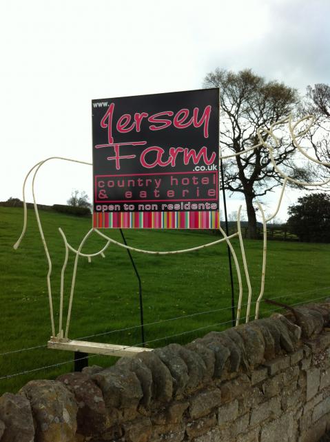 By CJO 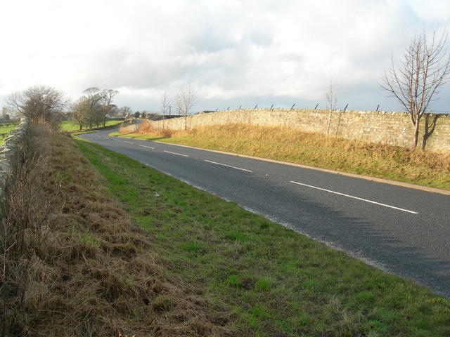 By Dusty 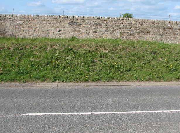 By ted See 1 more in the album. |
![]() 1st Apr 2024 11:40 by BasilDowl
1st Apr 2024 11:40 by BasilDowl
FB Number: Not logged Condition: Destroyed Score: 1/10
![]() 24th Sep 2023 14:08 by A1Mushroom
24th Sep 2023 14:08 by A1Mushroom
FB Number: Not logged Condition: Destroyed Score: 5/10
Long gone.
![]() 10th Sep 2022 16:47 by Mark-UKUS
10th Sep 2022 16:47 by Mark-UKUS
FB Number: Not logged Condition: Destroyed Score: 3/10
Parked up in the Runa Farm entrance and walked back to the approximate location of the pillar. The location appears to have been at the top of the verge by the wall. The prickly trees are staring to take hold so it wasn't much fun poking around up there.
![]() ©Mark-UKUS
©Mark-UKUS
![]() 2nd Aug 2020 12:37 by FrankR
2nd Aug 2020 12:37 by FrankR
FB Number: Not logged Condition: Destroyed Score: 3/10
![]() 4th Jul 2020 10:45 by weekender
4th Jul 2020 10:45 by weekender
FB Number: Not logged Condition: Destroyed Score: 2/10
![]() 28th Jan 2019 12:01 by jonglew
28th Jan 2019 12:01 by jonglew
FB Number: Not logged Condition: Destroyed Score: 3/10
OS record this destroyed June 1978. Was on N side road, most likely lost to a road improvement scheme.
![]() 18th Oct 2017 13:10 by rupertal
18th Oct 2017 13:10 by rupertal
FB Number: Not logged Condition: Destroyed Score: 2/10
![]() 13th Jul 2017 21:16 by Ant1974
13th Jul 2017 21:16 by Ant1974
FB Number: Not logged Condition: Destroyed Score: 5/10
![]() 2nd Jul 2017 15:50 by dugswell2
2nd Jul 2017 15:50 by dugswell2
FB Number: GONE Condition: Destroyed Score: 4/10
Long gone.
![]() 8th Apr 2016 20:32 by Particle
8th Apr 2016 20:32 by Particle
FB Number: Not logged Condition: Destroyed Score: 5/10
![]() 14th Oct 2015 15:45 by agentmancuso
14th Oct 2015 15:45 by agentmancuso
FB Number: Not logged Condition: Destroyed Score: 5/10
Wandered up from town past hill top along to FB & down RoW.
![]() 6th Sep 2015 00:00 by dogwalking
6th Sep 2015 00:00 by dogwalking
Gridref: NZ 06803 16894 FB Number: Not logged Condition: Destroyed Score: 0/10
yes it has gone
![]() 2nd Aug 2012 20:02 by PeteBoggs
2nd Aug 2012 20:02 by PeteBoggs
FB Number: Not logged Condition: Destroyed Score: 1/10
Nothing to see
![]() 22nd Apr 2012 11:40 by CJO
22nd Apr 2012 11:40 by CJO
FB Number: Not logged Condition: Destroyed Score: 3/10
135 paces west from the Jersey Farm Hotel
![]() 16th Apr 2012 14:18 by Border Peat
16th Apr 2012 14:18 by Border Peat
Gridref: NZ 06807 16892 FB Number: Not logged Condition: Destroyed Score: 4/10
Missing
![]() 31st May 2010 14:50 by swampysean
31st May 2010 14:50 by swampysean
FB Number: Not logged Condition: Destroyed Score: 0/10
![]() 31st May 2010 14:50 by craftinessa
31st May 2010 14:50 by craftinessa
FB Number: Not logged Condition: Destroyed Score: 0/10
![]() 17th Nov 2009 14:10 by Dusty
17th Nov 2009 14:10 by Dusty
FB Number: Not logged Condition: Destroyed Score: 2/10
![]() 2nd May 2009 17:00 by ted
2nd May 2009 17:00 by ted
FB Number: Not logged Condition: Destroyed Score: 0/10
Gone to road 'improvements'.
![]() Sunningdale Farm site
Sunningdale Farm site
![]() 5th Nov 2008 11:05 by Late starter
5th Nov 2008 11:05 by Late starter
FB Number: Not logged Condition: Destroyed Score: 0/10
Missing under newish road.
![]() 21st Jul 2008 16:15 by senrabyar
21st Jul 2008 16:15 by senrabyar
FB Number: Not logged Condition: Destroyed Score: 5/10
Previous visit 7th June 2008 17:25 - but in vehicle in motion. Stopped properly this time, and walked backwards and forwards across the busy road to guarentee within 1m (and perhaps 5m below) original position. Why are I visiting the middle of a busy road where a trig point once stood higher somewhat higher than my head some 30 years ago? Perhaps the next bagger will be able to answer.
![]() 5th Dec 2006 15:15 by Bergfuehrer
5th Dec 2006 15:15 by Bergfuehrer
FB Number: Not logged Condition: Destroyed Score: 1/10
County Durham. Why am I visiting a road at a point where a trig was destroyed 28 years ago?
![]() 1st Nov 2006 13:00 by jimmy
1st Nov 2006 13:00 by jimmy
FB Number: Not logged Condition: Destroyed Score: 0/10
yep! it is long gone to road works
![]() 9th Oct 2005 12:00 by peregrinus
9th Oct 2005 12:00 by peregrinus
FB Number: Not logged Condition: Destroyed Score: 3/10
![]() 22nd Sep 2005 16:50 by rhayader_wanderer
22nd Sep 2005 16:50 by rhayader_wanderer
FB Number: Not logged Condition: Destroyed Score: 2/10
3..2..1.. bump next somewhere under widended road
![]() 6th Mar 2005 12:00 by iainmac
6th Mar 2005 12:00 by iainmac
FB Number: Not logged Condition: Destroyed Score: 0/10
Probably gone to road widening/improvement. Trigonomy/GRP has it as destroyed.
![]()
![]() 29th Dec 1983 00:00 by RogerTempleman
29th Dec 1983 00:00 by RogerTempleman
FB Number: Not logged Condition: Destroyed Score: 1/10
Not found on visit: subsequently told by OS that pillar was destroyed in 1978.
![[map]](/img/trig-map.png.php?t=6259&b=2&l=0&)