![[UK map]](/img/locationmap.png)
| OSGB36 trig archive spreadsheet - IW | |||||||||||||
|---|---|---|---|---|---|---|---|---|---|---|---|---|---|
| Trig Name | Original Name | New Name | EASTING | NORTHING | HEIGHT | ORDER | TYPE OF MARK | Computing Date | CLASS OF LEVELLING | Date of Levelling | LEVELLING DATUM | DESTROYED MARK INDICATOR | COMMENTS |
| Swinden | SD96/T46 | SD96T046 | 397636.35 | 461152.52 | 291.388 | 3 | PILLAR | 01/06/1951 | 2 | 01/06/1951 | N | 1 | Destroyed 08/90 |
Nearby trigpoints, placenames
There are 12 photos for this trigpoint (view album).
This trigpoint:
Is ranked joint 22555th with 62 other trigs (more).
Has a mean score of 3.17/10 (from 24 logged visits)
Was First logged: 4th Apr 1983
Was Last found intact: 4th Apr 1983
Was Last logged: 6th Mar 2022
Of the 24 logged visits,
3 recorded a location and of these....
All were within 11440m
The average error was 3835m
The closest was 2m
You are not logged in. You must login if you wish to log a visit.
Selection of photos for this Pillar. By Aye Jimmy  By Earby Rambler  ©Hands 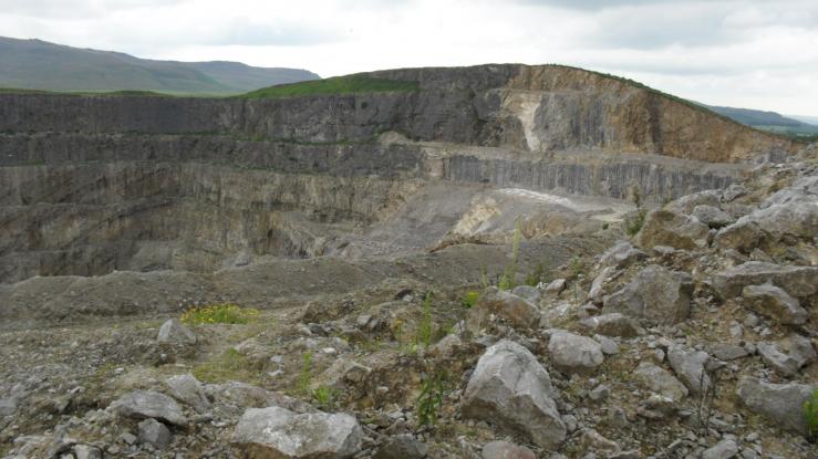 ©PeteBoggs  By Keith Stevens  By MAC.HAWK See 6 more in the album. |
![]() 6th Mar 2022 18:30 by Thomas David Whitaker
6th Mar 2022 18:30 by Thomas David Whitaker
FB Number: Not logged Condition: Not Logged Score: 3/10
Got a look at the gaping quarry from the Linton road and then had a wander up Moor Lane to see the shell of the hill. Promised my wife I wouldn't go any nearer the quarry to look at the fresh air where the pillar would have been. But that was before I got home and saw Aye Jimmy's fantastic picture.So next time I'm in the area...
![]() 12th Feb 2022 13:50 by Aye Jimmy
12th Feb 2022 13:50 by Aye Jimmy
FB Number: Not logged Condition: Destroyed Score: 4/10
Trig long gone. Impressive views into quarry. though.
![]() Swinden The view. Trig would have been about 40m forward from here...
Swinden The view. Trig would have been about 40m forward from here...
![]() 9th Jan 2022 12:00 by Mickandkim
9th Jan 2022 12:00 by Mickandkim
Gridref: SD 97600 61100 FB Number: S5562 Condition: Destroyed Score: 1/10
Long gone to quarry
![]() 21st Dec 2021 18:25 by Ronaldo333
21st Dec 2021 18:25 by Ronaldo333
FB Number: Not logged Condition: Destroyed Score: 5/10
![]() 6th Jun 2021 17:50 by srichy20
6th Jun 2021 17:50 by srichy20
Gridref: SD 97227 49720 FB Number: Not logged Condition: Destroyed Score: 5/10
![]() 8th Aug 2020 13:40 by Earby Rambler
8th Aug 2020 13:40 by Earby Rambler
FB Number: Not logged Condition: Destroyed Score: 2/10
Photo taken from Boss Moor track on way down from The Weets.
![]() 22nd Feb 2018 10:45 by dugswell2
22nd Feb 2018 10:45 by dugswell2
FB Number: GONE Condition: Destroyed Score: 5/10
Long gone.
![]() 23rd Oct 2017 15:30 by Hands
23rd Oct 2017 15:30 by Hands
FB Number: Not logged Condition: Destroyed Score: 2/10
walked along Moor Lane to view the Quarry
![]() ©Hands
©Hands
![]() 6th Nov 2016 20:01 by pendlelill
6th Nov 2016 20:01 by pendlelill
FB Number: Not logged Condition: Destroyed Score: 1/10
from path to north, came up here in the 60's, quarry now a lot bigger!
![]() 1st Aug 2016 00:00 by rupertal
1st Aug 2016 00:00 by rupertal
FB Number: Not logged Condition: Destroyed Score: 3/10
![]() 24th Jan 2016 00:00 by dogwalking
24th Jan 2016 00:00 by dogwalking
Gridref: SD 97636 61155 FB Number: Not logged Condition: Destroyed Score: 1/10
Gone
![]() 9th Apr 2015 12:57 by tigger4242
9th Apr 2015 12:57 by tigger4242
FB Number: Not logged Condition: Destroyed Score: 5/10
![]() 16th Jul 2014 15:52 by FrankR
16th Jul 2014 15:52 by FrankR
FB Number: Not logged Condition: Destroyed Score: 2/10
![]() 27th Oct 2013 13:30 by Particle
27th Oct 2013 13:30 by Particle
FB Number: Not logged Condition: Destroyed Score: 4/10
Went along PROW to north and saw great big hole where hill used to be.
![]() 20th Jan 2013 16:20 by redDragon
20th Jan 2013 16:20 by redDragon
FB Number: Not logged Condition: Destroyed Score: 3/10
I didnt bother venturing up there, but could see from quite a distance that it had gone to the quarry.
![]() 18th Nov 2012 14:02 by Paulus66
18th Nov 2012 14:02 by Paulus66
FB Number: Not logged Condition: Destroyed Score: 0/10
Recorded as a missing 'drive-by', having driven past literally hundreds of times. I wonder if the Trig really was destroyed or whether it's sat in someone's garden somewhere ?
![]() 12th Jul 2011 13:31 by PeteBoggs
12th Jul 2011 13:31 by PeteBoggs
FB Number: Not logged Condition: Destroyed Score: 2/10
Used prow to north and trespassed.Highlights include a dead rabbit,a dead sheep,an enormous eyesore of a quarry and a complete absence of any trig
![]() ©PeteBoggs
©PeteBoggs
![]() 14th Dec 2010 14:20 by painterman61
14th Dec 2010 14:20 by painterman61
FB Number: Not logged Condition: Destroyed Score: 5/10
long gone this one massive quarry still in use in valley.
![]() 8th Sep 2010 20:22 by Triggers
8th Sep 2010 20:22 by Triggers
FB Number: Not logged Condition: Destroyed Score: 5/10
Half hearted attempt to locate a trig that i knew wasn't there. Did a circuit of quarry via prow to north
![]() 11th Sep 2008 15:18 by Keith Stevens
11th Sep 2008 15:18 by Keith Stevens
FB Number: Not logged Condition: Destroyed Score: 2/10
Walked along the bridle path to north to get my picture. Pillar used to be about 50m NE os the now SE edge. Pillar No used to be S5562
![]() 19th Nov 2006 14:00 by MAC.HAWK
19th Nov 2006 14:00 by MAC.HAWK
FB Number: Not logged Condition: Destroyed Score: 5/10
The Mental Health Act (1983) springs to mind. Why would anyone with (allegedly) a full set of 'marbles' hike miles to 'visit' (A): a trig that's no longer there (I can just about understand that - you might get a view or evidence that it was once there) & (B): The ground that it sat on has disappeared some time since & the area is a fenced off Danger Area. I'll come quietly doctor, I don't know why but it just 'had to be done'. There's access from the north via a gate 100 yards to the right of the bridleway and whilst the area is fenced off with a multitude of warning signs, just beyond the gate is a step stile giving access to the quarry (strange?). The quarry's an eyesore but there's a decent view over Cracoe to the War Memorial & the Rylstone Cross. No cars. on foot.
![]() Swinden 19/11/2006©MAC.HAWK
Swinden 19/11/2006©MAC.HAWK![]() Swinden 19/11/2006
Swinden 19/11/2006![]() Gerraway!! 19/11/2006
Gerraway!! 19/11/2006
![]() 15th Aug 2004 12:00 by peregrinus
15th Aug 2004 12:00 by peregrinus
FB Number: TP gone Condition: Destroyed Score: 6/10
No trace on site: former summit quarried, resultant summit scenic but somewhat undercut - quarry edge: remaining summit is cut-away steep grassy slope
![]() 31st May 2004 14:00 by ted
31st May 2004 14:00 by ted
FB Number: Not logged Condition: Destroyed Score: 0/10
Gone - no big surprise. Swinden quarry has grown steadily over the years and is still active.
![]() Edge of quarry The trig would have been just inside the present
edge of the quarry. NOTE - I don't recommend
anyone visiting this site for obvious reasons.
Edge of quarry The trig would have been just inside the present
edge of the quarry. NOTE - I don't recommend
anyone visiting this site for obvious reasons.![]() From a distance Trig was just beyond the current highest point.
Cracoe memorial on the edge of Barden moor in
the background.
From a distance Trig was just beyond the current highest point.
Cracoe memorial on the edge of Barden moor in
the background.![]() map OS 1:25000 Malham and Upper Wharfedale (dated 1977)
since when the quarry has grown significantly.
map OS 1:25000 Malham and Upper Wharfedale (dated 1977)
since when the quarry has grown significantly.
![]() 4th Apr 1983 00:00 by RogerTempleman
4th Apr 1983 00:00 by RogerTempleman
FB Number: S5562 Condition: Good Score: 5/10
Off white pillar near edge of quarry at Cracoe with interesting views over the quarry.
![]() Trig pillar S5562 at Cracoe, North Yorkshire
Trig pillar S5562 at Cracoe, North Yorkshire
![[map]](/img/trig-map.png.php?t=6283&b=2&l=0&)