![[UK map]](/img/locationmap.png)
| OSGB36 trig archive spreadsheet - IW | |||||||||||||
|---|---|---|---|---|---|---|---|---|---|---|---|---|---|
| Trig Name | Original Name | New Name | EASTING | NORTHING | HEIGHT | ORDER | TYPE OF MARK | Computing Date | CLASS OF LEVELLING | Date of Levelling | LEVELLING DATUM | DESTROYED MARK INDICATOR | COMMENTS |
| Brown Wardle | SE02/T6 | SE02T006 | 389834.22 | 418662.03 | 399.915 | 3 | BLOCK | 01/06/1948 | 1 | 01/11/1956 | N | 0 |
Nearby trigpoints, placenames
There are 32 photos for this trigpoint (view album).
This trigpoint:
Is ranked joint 15834th with 69 other trigs (more).
Has a mean score of 4.70/10 (from 37 logged visits)
Was First logged: 10th Jul 1997
Has never been found intact
Was Last logged: 10th Jul 2023
Of the 37 logged visits,
9 recorded a location and of these....
All were within 76m
The average error was 18m
2 were exact
You are not logged in. You must login if you wish to log a visit.
Selection of photos for this Pillar. ©meltdiceburg  By Wheresthatpenguin  By cathy trickett  By Wayne Mac 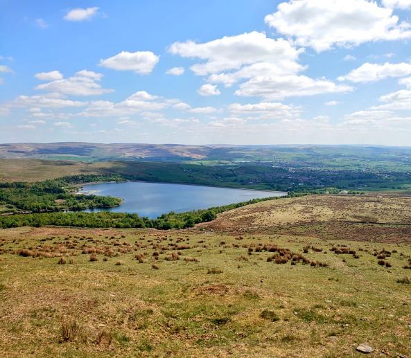 By John DCC See 27 more in the album. |
![]() 10th Jul 2023 21:11 by meltdiceburg
10th Jul 2023 21:11 by meltdiceburg
FB Number: Not logged Condition: Remains Score: 6/10
An evening walk incorporating Birch Hill, Watergrove trig, before heading back via Brown Wardle Hill. A pleasant walk with some nice views. I hadn't realised this cairn contained the remnants of the trig. Certainly nothing more than a few bits of concrete mixed in so a toss up between logging as remains and destroyed but I'll go with the former.
![]() Dottie ©meltdiceburg
Dottie ©meltdiceburg
![]() 20th May 2022 16:30 by Kevlar
20th May 2022 16:30 by Kevlar
FB Number: Not logged Condition: Remains Score: 2/10
As said by others, the pillar is destroyed, but at least there is something there (cairn) to mark the spot. I visited on a blustery day so didn't hang around. Onwards to the Water grove trig.
![]() 26th Mar 2022 14:10 by Wheresthatpenguin
26th Mar 2022 14:10 by Wheresthatpenguin
Gridref: SD 89834 18662 FB Number: 11076 Condition: Remains Score: 3/10
Parked on Acre Street. Took the public right of way (PRoW) from there up to the summit of Brown Wardle Hill and the cairn. Whilst the pillar has gone, there are remains of it still within the cairn.
![]() 1st Apr 2021 16:45 by cathy trickett
1st Apr 2021 16:45 by cathy trickett
Gridref: SD 89830 18662 FB Number: Not logged Condition: Remains Score: 5/10
![]()
![]() 1st Apr 2021 16:45 by cathy trickett
1st Apr 2021 16:45 by cathy trickett
Gridref: SD 89830 18662 FB Number: Not logged Condition: Remains Score: 5/10
![]() 6th Dec 2020 10:34 by Wayne Mac
6th Dec 2020 10:34 by Wayne Mac
FB Number: Not logged Condition: Remains Score: 7/10
From Watergrove Reservoir car park followed tracks to south base of hill to large cairn, then walked over to the true summit on a grassy mound further along. Came off N and followed tracks back to the reservoir from where we visited the trig pillar of Water Grove. Couldnt even find anything what looked like remains to be honest
![]() 13th Nov 2020 13:20 by chevyfire
13th Nov 2020 13:20 by chevyfire
FB Number: Not logged Condition: Destroyed Score: 5/10
walked from b
![]() 14th May 2020 13:31 by John DCC
14th May 2020 13:31 by John DCC
Gridref: SD 89837 18664 FB Number: Not logged Condition: Remains Score: 6/10
![]()
![]()
![]() 4th Apr 2020 12:40 by greenbell
4th Apr 2020 12:40 by greenbell
FB Number: 11076 Condition: Remains Score: 6/10
Visit to supermarket and walk trig. Easy to exercise and social distance here. Can see an increase in intersections during this time so a visit to some rubble on off roader, mine scarred hills is a treat. On the plus side they are strange empty beautiful places - full of skylarks, shapely hill.
![]()
![]()
![]()
![]() 20th Apr 2019 10:50 by Earby Rambler
20th Apr 2019 10:50 by Earby Rambler
FB Number: Not logged Condition: Remains Score: 5/10
Visited whilst on BM hunt in the area,great find peregrinus "top man." I found & put remains back on top of the rock.
![]() 19th Apr 2019 20:09 by painterman61
19th Apr 2019 20:09 by painterman61
FB Number: 11076 Condition: Remains Score: 6/10
Revisit after many years had to go its in Lancashire so a mini remains completion.
![]() Cairn ©painterman61
Cairn ©painterman61![]() View to Rochdale ©painterman61
View to Rochdale ©painterman61
![]() 23rd Mar 2019 14:06 by peregrinus
23rd Mar 2019 14:06 by peregrinus
FB Number: Not logged Condition: Remains Score: 5/10
On cairn I found 2 small chunks of trig each with a section of the circular centre tube void, also a chunk with level face presumably also from trig. Placed all three on a boulder together. Doubtless more bits in cairn. Summit is 37m north, visited a decade ago but unaware of trig connection. Should be a Block here but not tooled up to find it. Approached from west. 5 out of 6 BMs en route
![]() trig remains including circular tube void
trig remains including circular tube void ![]() trig remains including circular tube void
trig remains including circular tube void ![]() trig remains placed on boulder by cairn
trig remains placed on boulder by cairn
![]() 22nd Sep 2018 12:00 by Mickandkim
22nd Sep 2018 12:00 by Mickandkim
Gridref: SD 89834 18662 FB Number: 11076 Condition: Destroyed Score: 2/10
Gone
![]() 18th Sep 2018 11:15 by Ant1974
18th Sep 2018 11:15 by Ant1974
FB Number: Not logged Condition: Destroyed Score: 5/10
![]() 5th Dec 2017 14:00 by Hands
5th Dec 2017 14:00 by Hands
FB Number: Not logged Condition: Destroyed Score: 3/10
From Watergrove resr car-park followed footpaths and rutted tracks to a cairn at the top of the hill, nice view point , the nearby boundary stone is now toppled
![]() ©Hands
©Hands
![]() 25th Aug 2017 13:34 by catman
25th Aug 2017 13:34 by catman
Gridref: SD 89832 18665 FB Number: Not logged Condition: Destroyed Score: 5/10
![]() 15th May 2016 13:00 by SJW1960
15th May 2016 13:00 by SJW1960
FB Number: Not logged Condition: Destroyed Score: 5/10
![]() 2nd Dec 2015 00:00 by dogwalking
2nd Dec 2015 00:00 by dogwalking
Gridref: SD 89833 18664 FB Number: Not logged Condition: Destroyed Score: 3/10
nice area no pillar
![]() 26th Apr 2014 00:00 by rupertal
26th Apr 2014 00:00 by rupertal
FB Number: Not logged Condition: Destroyed Score: 4/10
![]() 23rd Mar 2014 13:00 by Aye Jimmy
23rd Mar 2014 13:00 by Aye Jimmy
FB Number: Not logged Condition: Destroyed Score: 5/10
From the Church of St John in Facit. Pillar gone, never thought to examine rubble of cairn for evidence.
![]() Brown Wardle Cairn at site of trig.
Brown Wardle Cairn at site of trig.
![]() 16th Feb 2014 15:17 by paulxtr
16th Feb 2014 15:17 by paulxtr
FB Number: Not logged Condition: Destroyed Score: 7/10
Good viewpoint. Pity the trig's gone. I agree with John Riley and painterman61 about the possible location of the trig - NW of the large cairn is a slightly raised patch of land.
![]() Brown Wardle ©paulxtr
Brown Wardle ©paulxtr
![]() 11th Nov 2012 13:30 by fell-finder
11th Nov 2012 13:30 by fell-finder
FB Number: Not logged Condition: Destroyed Score: 5/10
I'll be honest, it wasnt until I went on here that I even knew there was a Trig on this lonely hill at some point in time. The cairn was good for a moorland high point, and the old way pointers were intersting too. Bagged this on a 13.4 mile circular walk from Walsden bagging three Trigs in total. You can follow a detailed write up and route by typing Fell Finder into Google - thanks.
![]() Way pointer and cairn on the summit of Brown Wardle Hill
Way pointer and cairn on the summit of Brown Wardle Hill
![]() 12th Oct 2011 00:00 by Curlew
12th Oct 2011 00:00 by Curlew
FB Number: Not logged Condition: Not Logged Score: 5/10
![]() 11th Jun 2011 11:44 by Terry L
11th Jun 2011 11:44 by Terry L
FB Number: Not logged Condition: Destroyed Score: 7/10
Old maps indicate trig stood within 400m ring contour, just on Lancs side of boundary with Gtr Manchester - this runs along Rossendale Way. So-called cairn just pile of rubble - one wonders if it contains bits of the pillar. Public. Access Land - roam freely across open country above Watergrove reservoir. Make for obvious col between Middle Hill & Brown Wardle, then strike up left to summit. Long-horned cattle on hillside.
![]() Cairn of rubble on Brown Wardle
Cairn of rubble on Brown Wardle
![]() 14th May 2011 09:49 by PeteBoggs
14th May 2011 09:49 by PeteBoggs
FB Number: Not logged Condition: Destroyed Score: 5/10
No sign of a trig but a pleasant walk up from Watergrove res with good views
![]() ©PeteBoggs
©PeteBoggs
![]() 8th Apr 2011 14:43 by redDragon
8th Apr 2011 14:43 by redDragon
FB Number: Not logged Condition: Destroyed Score: 4/10
Theres certainly no remains of the trig here. Worth climbing up here for the views though.
![]() 3rd Feb 2011 09:25 by painterman61
3rd Feb 2011 09:25 by painterman61
Gridref: SD 89900 18700 FB Number: Not logged Condition: Destroyed Score: 6/10
Walked from facit village,nice stone track at start then grassy trails.Was lucky farmer was feeding haylage to 60+ beef cattle which were near pathway! Large flat top trig sadly long gone possible location NW of summit cairn,fine views over Rochdale
![]() possible location ©painterman61
possible location ©painterman61![]() Summit cairn ©painterman61
Summit cairn ©painterman61![]() Boundry stone ©painterman61
Boundry stone ©painterman61
![]() 12th Jan 2008 00:00 by Curlew
12th Jan 2008 00:00 by Curlew
FB Number: Not logged Condition: Not Logged Score: 5/10
Not there
![]() 29th May 2006 11:30 by m0sgb
29th May 2006 11:30 by m0sgb
FB Number: Not logged Condition: Destroyed Score: 5/10
Walked from Wardle to Thieveley Pike nice views,,But rained on Hades Hill and Shaneyford and on the pike
![]() 24th Mar 2006 13:00 by MAC.HAWK
24th Mar 2006 13:00 by MAC.HAWK
FB Number: Not logged Condition: Destroyed Score: 4/10
Gone to 'the great trig home in the sky'. The nearby boundary post acts as a sort of surrogate trig. Very, very badly eroded area - probably the worst I've come across on all my travels. The top and surrounding area has been desecrated by off road motor vehicles with deep pitted and very wide tracks. Very poor weather today with low cloud hanging on to the top of the moor making the mood even more depressing. To add insult to injury I lost my digital camera on todays outing - I doubt I'll be returning in the near future for the photo's!! The trigs still shown on my 1983 Landranger map.
![]() 12th Nov 2005 12:00 by ted
12th Nov 2005 12:00 by ted
FB Number: Not logged Condition: Destroyed Score: 0/10
Grassy top; cairn and stone posts but no trig. Previously visited May 1988 - wasn't there then either. Still raining.
![]() Brown Wardle no trig
Brown Wardle no trig
![]() 15th Oct 2005 14:41 by Triggers
15th Oct 2005 14:41 by Triggers
FB Number: Not logged Condition: Destroyed Score: 5/10
nice round of watergrove reservoir. good views of whitworth but no views of a trig point
![]() 30th Dec 2004 11:25 by John Riley
30th Dec 2004 11:25 by John Riley
FB Number: Not logged Condition: Destroyed Score: 3/10
There must have been at one time as it was shown on old maps but there definitely hasn't been one here since the mid eighties when I first ran in this area. Nevertheless its a good place for a run or a walk.
![]() Brown Wardle The approach from the South showing boundary stones.
Brown Wardle The approach from the South showing boundary stones.![]() Brown Wardle The flat summit looking North.
Brown Wardle The flat summit looking North.![]() Brown Wardle The summit cairn.
Brown Wardle The summit cairn.![]() Brown Wardle The possible site of the trig a few yards WNW of the cairn.
Brown Wardle The possible site of the trig a few yards WNW of the cairn.![]() Brown Wardle OS South Pennines map 1984.
Brown Wardle OS South Pennines map 1984.![]() Brown Wardle OS South Pennines map 1978.
Brown Wardle OS South Pennines map 1978.![]() Brown Wardle Brown Wardle Hill from the East.
Brown Wardle Brown Wardle Hill from the East.
![]() 10th Sep 2004 14:00 by P.Hogg
10th Sep 2004 14:00 by P.Hogg
FB Number: Not logged Condition: Destroyed Score: 5/10
![]() 10th Sep 2004 12:25 by Hedgehogg
10th Sep 2004 12:25 by Hedgehogg
FB Number: Not logged Condition: Destroyed Score: 5/10
![]() 1st Jan 1999 00:00 by mickandshane
1st Jan 1999 00:00 by mickandshane
Gridref: SD 89900 18700 FB Number: NONE Condition: Destroyed Score: 5/10
There was a pillar here in living memory. According to the OS the FB no was originally S4450 and this was later rebuilt as 11076. It was demolished due to repeated vandalism. There is a pile of stones to mark the site.
![]() 10th Jul 1997 16:20 by dugswell2
10th Jul 1997 16:20 by dugswell2
FB Number: GONE Condition: Destroyed Score: 5/10
Long gone like the one before.
![[map]](/img/trig-map.png.php?t=7323&b=2&l=0&)