![[UK map]](/img/locationmap.png)
| OSGB36 trig archive spreadsheet - IW | |||||||||||||
|---|---|---|---|---|---|---|---|---|---|---|---|---|---|
| Trig Name | Original Name | New Name | EASTING | NORTHING | HEIGHT | ORDER | TYPE OF MARK | Computing Date | CLASS OF LEVELLING | Date of Levelling | LEVELLING DATUM | DESTROYED MARK INDICATOR | COMMENTS |
| Conway Mountain | SH57/T15 | SH57T015 | 275979.14 | 377796.78 | 246.278 | 3 | BLOCK | 01/06/1953 | 2 | 01/06/1953 | N | 1 | Ht to bolt in block. Dest 02/73 |
Nearby trigpoints, placenames
There are 19 photos for this trigpoint (view album).
This trigpoint:
Is ranked joint 2952nd with 31 other trigs (more).
Has a mean score of 6.17/10 (from 23 logged visits)
Was First logged: 20th Oct 2010
Was Last found intact: 30th May 2018
Was Last logged: 22nd Apr 2023
Of the 23 logged visits,
5 recorded a location and of these....
All were within 47m
The average error was 14m
1 was exact
You are not logged in. You must login if you wish to log a visit.
Selection of photos for this Surface Block. By CJO  By Aye Jimmy  ©painterman61 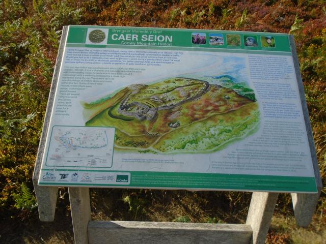 By Earby Rambler  By tom See 14 more in the album. |
![]() 22nd Apr 2023 16:06 by CJO
22nd Apr 2023 16:06 by CJO
FB Number: Not logged Condition: Destroyed Score: 5/10
Great views with heavy April showers
![]() Not a block at summit
Not a block at summit
![]() 29th Aug 2021 15:35 by Aye Jimmy
29th Aug 2021 15:35 by Aye Jimmy
FB Number: Not logged Condition: Destroyed Score: 7/10
High mark for the view.
![]() Conwy Mountain Summit.
Conwy Mountain Summit.
![]() 25th Jun 2019 00:00 by Bramley
25th Jun 2019 00:00 by Bramley
FB Number: Not logged Condition: Destroyed Score: 7/10
![]() 5th Jan 2019 11:55 by rupertal
5th Jan 2019 11:55 by rupertal
FB Number: Not logged Condition: Destroyed Score: 7/10
![]() 28th Jul 2018 17:50 by Earby Rambler
28th Jul 2018 17:50 by Earby Rambler
FB Number: Not logged Condition: Destroyed Score: 10/10
Visited with P61 after visiting Conwy FBM,fantastic views best top of the day hence the 10.
![]() Info board
Info board ![]() Approach
Approach ![]() Site
Site ![]() Summit Stone
Summit Stone
![]() 28th Jul 2018 17:50 by painterman61
28th Jul 2018 17:50 by painterman61
FB Number: Not logged Condition: Couldn't find it Score: 7/10
Fine views from this one old bm found on rock.
![]() old mark ©painterman61
old mark ©painterman61![]() site ©painterman61
site ©painterman61
![]() 30th May 2018 23:12 by Ant1974
30th May 2018 23:12 by Ant1974
FB Number: Not logged Condition: Slightly damaged Score: 5/10
![]() 24th Mar 2018 10:01 by FrankR
24th Mar 2018 10:01 by FrankR
FB Number: Not logged Condition: Destroyed Score: 2/10
Found existing rock and markings in original spot.
![]() 23rd Apr 2017 11:05 by VinceTP
23rd Apr 2017 11:05 by VinceTP
Gridref: SH 75983 77806 FB Number: Not logged Condition: Slightly damaged Score: 5/10
![]() 19th Feb 2017 09:19 by peregrinus
19th Feb 2017 09:19 by peregrinus
FB Number: Not logged Condition: Destroyed Score: 5/10
As Dusty says this isn't the trig but an arrow pointing to where it was. os have Block, Ht to bolt in block. Dest 02/73. Arrow isn't a BM either: the block itself was levelled.
![]() 4th Feb 2017 16:30 by llanowor
4th Feb 2017 16:30 by llanowor
FB Number: Not logged Condition: Destroyed Score: 7/10
![]() 20th Jun 2016 13:40 by Dusty
20th Jun 2016 13:40 by Dusty
FB Number: Not logged Condition: Destroyed Score: 7/10
OS have as destroyed. What is left is probably some kind of witness mark pointing to its location.
![]() 12th Sep 2015 15:41 by Whats the Point
12th Sep 2015 15:41 by Whats the Point
Gridref: SH 75932 77797 FB Number: Not logged Condition: Slightly damaged Score: 8/10
Well there may not be a pillar up here but it's a place not to be missed. Certainly on a day like today. Pity about that massive wind farm out to sea. Bet if you come back in 50 years the view and the castle will still be here but the wind farm will be gone. I consider myself an environmentalist and an engineer but these things are a nonsense.
![]() Conwy Mountain
Conwy Mountain ![]() looking down on The Castle.
looking down on The Castle.
![]() 8th Sep 2015 15:56 by dugswell2
8th Sep 2015 15:56 by dugswell2
FB Number: Not logged Condition: Destroyed Score: 5/10
OS have as destroyed.
![]() 12th Jun 2014 13:03 by tom
12th Jun 2014 13:03 by tom
FB Number: Not logged Condition: Damaged Score: 7/10
The trig is sited in a hill fort on top of a mountain in Snowdonia National Park to the west of Conwy town. A flat rock was found with OSTP and an arrow engraved on it, but no bolt. The site was reached by walking the paths and tracks from the Sychnant Pass. The mountain has outstanding views of the North Wales coast from Anglesey to Flintshire as well as the mountains of Snowdonia, the Denbighshire hills and the Clwydian Range.
![]()
![]() 6th Jun 2014 12:55 by NonCompassMentis
6th Jun 2014 12:55 by NonCompassMentis
Gridref: SH 75979 77796 FB Number: Not logged Condition: Slightly damaged Score: 8/10
Walked up from Conwy noting the bolt on the way up. Views simply brilliant.
![]() 16th Aug 2013 09:13 by cazamaloo
16th Aug 2013 09:13 by cazamaloo
FB Number: Not logged Condition: Couldn't find it Score: 5/10
![]() 8th Mar 2013 16:20 by redDragon
8th Mar 2013 16:20 by redDragon
FB Number: Not logged Condition: Slightly damaged Score: 6/10
Obvious large square rock with initials OSTP and an arrow at the highest point of the hill. I also found the mentioned bolt, on the path down towards Conwy, its on a sloping rock left side of the path.
![]() 16th Feb 2013 16:14 by Caroline
16th Feb 2013 16:14 by Caroline
FB Number: Not logged Condition: Couldn't find it Score: 5/10
![]() 16th Feb 2013 09:09 by cazamaloo
16th Feb 2013 09:09 by cazamaloo
FB Number: Not logged Condition: Not Logged Score: 5/10
![]() 15th Nov 2011 13:33 by trigging on an island
15th Nov 2011 13:33 by trigging on an island
FB Number: Not logged Condition: Slightly damaged Score: 6/10
Visted on a walk from Conwy to Penmaenmawr to log several trigs in the area. I also noticed what appears to be a bolt on the side of a rock about 30-50 metres away along the path to the ENE (see pics).
![]() Is this another trig point nearby? Close up.
Is this another trig point nearby? Close up.![]() Walking pole marks the spot of the possible bolt The Great Orme behind gives a reference point
Walking pole marks the spot of the possible bolt The Great Orme behind gives a reference point
![]() 4th Aug 2011 11:50 by martinc
4th Aug 2011 11:50 by martinc
Gridref: SH 75985 77803 FB Number: Not logged Condition: Good Score: 5/10
My last find along the Cambrian Way. Broad arrow scratched in surface of a flat rock.
![]() 20th Oct 2010 13:15 by Meirion
20th Oct 2010 13:15 by Meirion
Gridref: SH 75985 77801 FB Number: NONE Condition: Slightly damaged Score: 8/10
I didnt expect to find anything here as the OS database states the the trigpoint here (bolt in block) was destroyed on the 02/73. I was mainly up here for the fantastic views & to see the hillfort. I was therefore surprised to come across a a flat stone with the letters OSTP (Ordnance Survey Triangulation Point?) carved into it together with a arrow. There was no sign of any bolt. Given it a high mark due to the views.
![]() OSTP ©Meirion
OSTP ©Meirion![]() OSTP ©Meirion
OSTP ©Meirion![]() OSTP on large flat stone in outcrop ©Meirion
OSTP on large flat stone in outcrop ©Meirion![]() Looking towards Conwy from OSTP ©Meirion
Looking towards Conwy from OSTP ©Meirion![]() Caer Seion ©Meirion
Caer Seion ©Meirion
![[map]](/img/trig-map.png.php?t=7668&b=2&l=0&)