![[UK map]](/img/locationmap.png)
| OSGB36 trig archive spreadsheet - IW | |||||||||||||
|---|---|---|---|---|---|---|---|---|---|---|---|---|---|
| Trig Name | Original Name | New Name | EASTING | NORTHING | HEIGHT | ORDER | TYPE OF MARK | Computing Date | CLASS OF LEVELLING | Date of Levelling | LEVELLING DATUM | DESTROYED MARK INDICATOR | COMMENTS |
| Warren Top | SE38/T102 | SE38T102 | 428083.74 | 457349.79 | 0.000 | 3 | RIVET | 01/06/1955 | 0 | 0 |
Nearby trigpoints, placenames
There are 3 photos for this trigpoint (view album).
This trigpoint:
Is ranked joint 23297th with 43 other trigs (more).
Has a mean score of 2.57/10 (from 7 logged visits)
Was First logged: 20th Jan 2013
Has never been found intact
Was Last logged: 18th Sep 2023
Of the 7 logged visits,
1 recorded a location
The error was 96m
You are not logged in. You must login if you wish to log a visit.
Selection of photos for this Rivet. By peregrinus 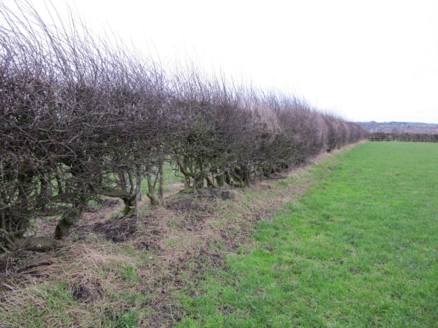 By ted  By CJO |
![]() 18th Sep 2023 07:30 by Mickandkim
18th Sep 2023 07:30 by Mickandkim
Gridref: SE 28000 57300 FB Number: Not logged Condition: Destroyed Score: 1/10
Gone
![]() 8th Jan 2023 12:33 by peregrinus
8th Jan 2023 12:33 by peregrinus
FB Number: Not logged Condition: Destroyed Score: 5/10
Small rounded boulder in gappy hedge, no trace of structure, GPS indicates E edge of soggy pasture next to hedge. Good research by ted.
![]() Location looking S GPS indicated 2-3 m into field, no trace of building
Location looking S GPS indicated 2-3 m into field, no trace of building
![]() 5th Oct 2016 11:39 by Ant1974
5th Oct 2016 11:39 by Ant1974
FB Number: Not logged Condition: Possibly missing Score: 5/10
![]() 29th May 2013 15:20 by Particle
29th May 2013 15:20 by Particle
FB Number: Not logged Condition: Possibly missing Score: 3/10
Took a quick look, not expecting to find anything and it was raining.
![]() 9th Feb 2013 09:20 by ted
9th Feb 2013 09:20 by ted
FB Number: Not logged Condition: Possibly missing Score: 0/10
No sign of any structure or block, apart from a discarded brick in the hedge. SE38/T102, National Archive document reference number OS 69/8681 dated 30-9-86 describes the mark as a Brass rivet on "concrete base of old building - now cracked" with 4 witness marks all within 1.5 metres. This would appear to have been a replacement for an asphalt disc on the building roof, placed in 1954. A sketch shows that the building was located on the W side of the hedge. The document also gives the bearings to other local marks: Nidd Moor, Bilton Ch Twr, Coporation Farm, Queen Ethelburgh's Sch Twr, Mount Pleasant and Killinghall Chapel Vane.
![]() Warren Top site
Warren Top site
![]() 4th Feb 2013 12:45 by PeteBoggs
4th Feb 2013 12:45 by PeteBoggs
FB Number: Not logged Condition: Possibly missing Score: 2/10
According to GPS its in or next to the hedge but not sign of rivet or possible surface block
![]() 20th Jan 2013 11:35 by CJO
20th Jan 2013 11:35 by CJO
FB Number: Not logged Condition: Possibly missing Score: 2/10
SE38 T102 RIVET. GPS places this in the hedge. This type of OS description typically suggests the rivet would be on a building or possible a rock outcrop. Non of which could be seen, admitadly under a covering of snow. There exists the possibilty that some form of surface block or rock is hiding in the hedge awaiting the spring thaw before revealing itself. the site offers excellent views over Harrogate
![[map]](/img/trig-map.png.php?t=11012&b=2&l=0&)