![[UK map]](/img/locationmap.png)
| OSGB36 trig archive spreadsheet - IW | |||||||||||||
|---|---|---|---|---|---|---|---|---|---|---|---|---|---|
| Trig Name | Original Name | New Name | EASTING | NORTHING | HEIGHT | ORDER | TYPE OF MARK | Computing Date | CLASS OF LEVELLING | Date of Levelling | LEVELLING DATUM | DESTROYED MARK INDICATOR | COMMENTS |
| South Woodfield Farm | SE73/T71 | SE73T071 | 464136.46 | 404083.80 | 11.300 | 13 | CUT | 01/06/1988 | 3 | 01/06/1988 | N | 0 | GPS HEIGHT NCE 88 |
Nearby trigpoints, placenames
There are 4 photos for this trigpoint (view album).
This trigpoint:
Is ranked joint 20805th with 72 other trigs (more).
Has a mean score of 3.00/10 (from 2 logged visits)
Was First logged: 4th May 2015
Has never been found intact
Was Last logged: 19th Mar 2018
Of the 2 logged visits,
0 recorded a location
You are not logged in. You must login if you wish to log a visit.
![]() 19th Mar 2018 22:34 by Ant1974
19th Mar 2018 22:34 by Ant1974
FB Number: Not logged Condition: Possibly missing Score: 5/10
![]() 4th May 2015 11:30 by ted
4th May 2015 11:30 by ted
FB Number: Not logged Condition: Possibly missing Score: 1/10
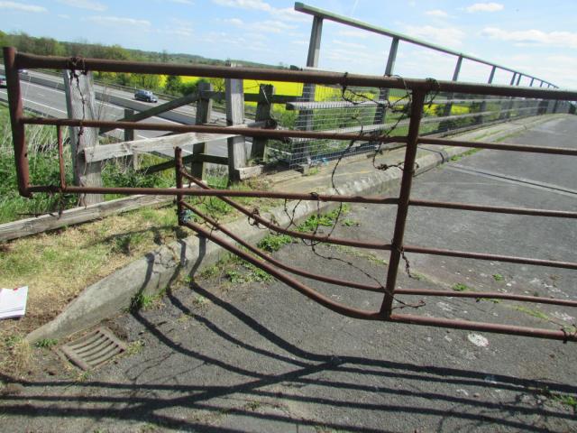
Straightforward access via track ESE from the road then NW following the field edge alongside the motorway. The grid ref corresponds to W side of gated farm bridge. An embankment raises the track to bridge level. The gate is damaged - beware trailing strands of barbed wire. Metal drain to each side of the gate. Drain surrounds examined carefully but nothing found. The metal is rusty in places with loose flakes. Various minor dents and scratches but nothing that suggests a trig mark. Also checked base of the metal parapet posts - smooth surface, no marks; possibly not original. Checked kerb stones for witness marks; also checked the nearby concrete surfaces although this would seem a less likely location. Noted drains/cover surround at base of embankment on N side; not checked as too far off GR. Took photos of all the possibilities and subsequently obtained the OS sketch. This shows the cut mark to have been on the SE corner of the drain cover at the NW side of the bridge. Nothing in the photo to suggest that it is still there; would guess that the relevant metal flake has detached.
![]() South Woodfield Farm site
South Woodfield Farm site![]() South Woodfield Farm drain cover
South Woodfield Farm drain cover![]() South Woodfield Farm detail of surround
South Woodfield Farm detail of surround![]() South Woodfield Farm OS sketch
South Woodfield Farm OS sketch
![[map]](/img/trig-map.png.php?t=17626&b=2&l=0&)