![[UK map]](/img/locationmap.png)
| OSGB36 trig archive spreadsheet - IW | |||||||||||||
|---|---|---|---|---|---|---|---|---|---|---|---|---|---|
| Trig Name | Original Name | New Name | EASTING | NORTHING | HEIGHT | ORDER | TYPE OF MARK | Computing Date | CLASS OF LEVELLING | Date of Levelling | LEVELLING DATUM | DESTROYED MARK INDICATOR | COMMENTS |
| Faugh | NY45/T20 | NY45T020 | 351082.77 | 554808.78 | 132.164 | 3 | PILLAR | 01/06/1953 | 1 | 01/06/1972 | N | 1 | Dest 03/76 |
Nearby trigpoints, placenames
There are 12 photos for this trigpoint (view album).
This trigpoint:
Is ranked joint 22253rd with 29 other trigs (more).
Has a mean score of 3.21/10 (from 14 logged visits)
Was First logged: 9th Feb 2004
Has never been found intact
Was Last logged: 26th Dec 2023
Of the 14 logged visits,
4 recorded a location and of these....
All were within 83m
The average error was 25m
2 were exact
You are not logged in. You must login if you wish to log a visit.
Selection of photos for this Pillar. By Wheresthatpenguin ©Mark-UKUS  ©jonglew  By peregrinus  By peregrinus 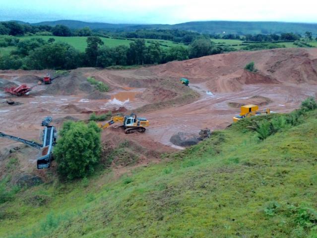 ©Moacky See 6 more in the album. |
![]() 26th Dec 2023 15:30 by Wheresthatpenguin
26th Dec 2023 15:30 by Wheresthatpenguin
Gridref: NY 51083 54809 FB Number: S6777 Condition: Destroyed Score: 0/10
Gone. Destroyed March 1976. Lost to sand quarry
![]() 20th May 2023 14:00 by Mickandkim
20th May 2023 14:00 by Mickandkim
Gridref: NY 51000 54800 FB Number: S6777 Condition: Destroyed Score: 1/10
Gone
![]() 3rd Apr 2023 10:13 by A1Mushroom
3rd Apr 2023 10:13 by A1Mushroom
FB Number: Not logged Condition: Destroyed Score: 5/10
Just a big sand pit, long gone.
![]() 1st Apr 2023 17:40 by Mark-UKUS
1st Apr 2023 17:40 by Mark-UKUS
FB Number: Not logged Condition: Destroyed Score: 5/10
Parked up at the String of Horses pub and went into the Nature Reserve opposite. Followed the path around to the barbed wire fence by the quarry road and got the feeling that no one was around so jumped over it next to the "Keep Out" sign. Followed the road to the main quarry workings and looked for the tree. No sign of anything so it looks like that bit of the planet has been dug up too. Contented myself that I'd got as close as I could to the original position so retraced my steps and popped in the pub for a beer.
![]() The quarry The pillar would have been about 100' above the piles of dark rubble.©Mark-UKUS
The quarry The pillar would have been about 100' above the piles of dark rubble.©Mark-UKUS
![]() 22nd Jan 2022 15:20 by dugswell2
22nd Jan 2022 15:20 by dugswell2
FB Number: GONE Condition: Destroyed Score: 5/10
Long gone
![]() 24th May 2018 12:04 by jonglew
24th May 2018 12:04 by jonglew
FB Number: Not logged Condition: Destroyed Score: 3/10
Parked at the wall box, got the BM. Walked up through trees from a field gate at NY 5093 5469 to edge of the quarry. I was approx 65m from where the pillar would have stood, but the hill is now one very big sand pit.
![]() The sandpit TP3124©jonglew
The sandpit TP3124©jonglew
![]() 10th Dec 2017 12:03 by peregrinus
10th Dec 2017 12:03 by peregrinus
FB Number: Not logged Condition: Destroyed Score: 5/10
From SW, up thru trees to sandpit overlook
![]() location 30m above the conveyor
location 30m above the conveyor![]() bonus BM on pillar box to SW
bonus BM on pillar box to SW
![]() 29th Jun 2017 21:40 by Moacky
29th Jun 2017 21:40 by Moacky
FB Number: Not logged Condition: Destroyed Score: 6/10
Accessed this evening. GPS took me to a tree adjacent to a moveable conveyor belt type vehicle (I'm sure it has a proper name). The GPS indicated an altitude of 333ft, which is exactly 100ft less than the original pillar. It is perhaps unnecessary to add that there was no sign of the pillar.
![]() The former location + 100ft ©Moacky
The former location + 100ft ©Moacky![]() Obvious tree, from above ©Moacky
Obvious tree, from above ©Moacky
![]() 8th Sep 2014 10:35 by PeteBoggs
8th Sep 2014 10:35 by PeteBoggs
FB Number: Not logged Condition: Destroyed Score: 1/10
As others have said just a big hole in ground now
![]() 26th Oct 2013 13:00 by ted
26th Oct 2013 13:00 by ted
FB Number: Not logged Condition: Destroyed Score: 0/10
Sand quarry; some indications that it is still in use.
![]() 7th Jul 2012 17:50 by CJO
7th Jul 2012 17:50 by CJO
FB Number: Not logged Condition: Destroyed Score: 5/10
Big hole in the ground, with some tree planting and regeneration taking place.
![]() 5th May 2012 18:41 by Border Peat
5th May 2012 18:41 by Border Peat
Gridref: NY 51083 54809 FB Number: Not logged Condition: Destroyed Score: 3/10
Private no access signs
![]() 21st Jul 2007 10:00 by chrisbombington
21st Jul 2007 10:00 by chrisbombington
Gridref: NY 51100 54800 FB Number: Not logged Condition: Destroyed Score: 1/10
Long gone
![]() Trig lost to sand quarry
Trig lost to sand quarry ![]() suspect trig suffered same fate as man on sign
suspect trig suffered same fate as man on sign
![]() 9th Feb 2004 17:00 by fasgadh
9th Feb 2004 17:00 by fasgadh
FB Number: Not logged Condition: Destroyed Score: 5/10
MIA - Now a disused sandpit, a huge disused sandpit. The hill has all but gone. Quite a scenic walk up to the lip of the crater though.
![[map]](/img/trig-map.png.php?t=3124&b=2&l=0&)