![[UK map]](/img/locationmap.png)
| OSGB36 trig archive spreadsheet - IW | |||||||||||||
|---|---|---|---|---|---|---|---|---|---|---|---|---|---|
| Trig Name | Original Name | New Name | EASTING | NORTHING | HEIGHT | ORDER | TYPE OF MARK | Computing Date | CLASS OF LEVELLING | Date of Levelling | LEVELLING DATUM | DESTROYED MARK INDICATOR | COMMENTS |
| Peter Hill | SE38/T70 | SE38T070 | 449850.83 | 472957.96 | 43.839 | 3 | PILLAR | 01/06/1955 | 1 | 01/03/1954 | N | 1 | Dest 07/59 |
Nearby trigpoints, placenames
There are 11 photos for this trigpoint (view album).
This trigpoint:
Is ranked joint 23878th with 50 other trigs (more).
Has a mean score of 2.63/10 (from 35 logged visits)
Was First logged: 13th Jun 1999
Has never been found intact
Was Last logged: 26th Aug 2023
Of the 35 logged visits,
3 recorded a location and of these....
All were within 77m
The average error was 25m
2 were exact
You are not logged in. You must login if you wish to log a visit.
Selection of photos for this Pillar. ©eon  ©eon ©Mark-UKUS  By BasilDowl 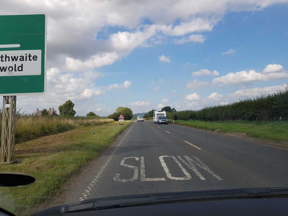 ©Pritch227 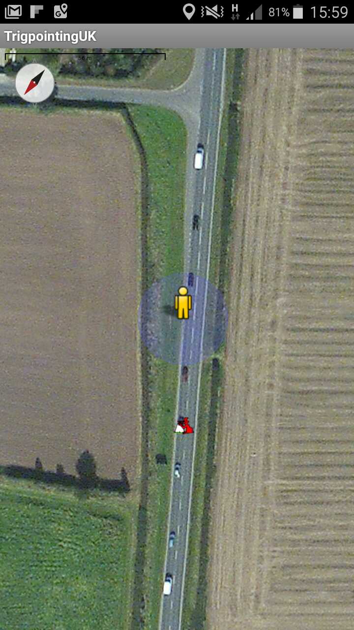 By peregrinus See 5 more in the album. |
![]() 26th Aug 2023 09:10 by Ian Robinson
26th Aug 2023 09:10 by Ian Robinson
FB Number: Not logged Condition: Destroyed Score: 0/10
Walk from Coldharbour Lane
![]() 23rd Feb 2023 00:00 by Ronaldo333
23rd Feb 2023 00:00 by Ronaldo333
FB Number: Not logged Condition: Not Logged Score: 5/10
Peter Hill S7881 Destroyed > Coldharbour Lane 11045 from GR: SE 49847 73062
![]() 9th Feb 2023 14:20 by haighr01
9th Feb 2023 14:20 by haighr01
FB Number: Not logged Condition: Destroyed Score: 2/10
Visited after a day working at the Nestle factory in York. Parked in the parking pull off the A19 to the S. Walked down the verge and tigged the road sign shown on these photos in lieu of the pillar - although the old map shown on here does suggest the pillar may have been on the other side of the road. No bother, as we know the story here and there is a nearby pillar to bag although I did Cold Harbour last year. 1 point added for view of the White Horse of Kilburn.
![]() 27th Jan 2023 10:03 by eon
27th Jan 2023 10:03 by eon
FB Number: Not logged Condition: Destroyed Score: 1/10
(2819) This one only had a very short shelf life - 8 years! No doubt lost to the A19. A replacement pillar is located nearby. Left car parked in passing place on New Road and walked the 200m to the location. Pillar history: Built on the 20th of February 1951, cost and when last maintained by the OS not listed in archive. Marked as destroyed July 1959. FB was S781.
![]() Map c1956 ©eon
Map c1956 ©eon![]() Location - just passed sign ©eon
Location - just passed sign ©eon
![]() 8th Sep 2022 16:15 by Mark-UKUS
8th Sep 2022 16:15 by Mark-UKUS
FB Number: Not logged Condition: Destroyed Score: 3/10
Left the car in the passing place for Coldharbour Lane TP and nipped around the corner to the road sign. Looks like the pillar would have been adjacent to the sign, either on the verge or just in the road.
![]() ©Mark-UKUS
©Mark-UKUS
![]() 18th Oct 2021 19:23 by A1Mushroom
18th Oct 2021 19:23 by A1Mushroom
FB Number: Not logged Condition: Destroyed Score: 5/10
Gone.
![]() 29th Oct 2020 14:45 by BasilDowl
29th Oct 2020 14:45 by BasilDowl
FB Number: Not logged Condition: Destroyed Score: 0/10
Bagged whilst visiting its replacement, Coldharbour Lane. The pillar would probably have been visible from the junction; as others have said, nothing else to report, it is long gone.
![]() Approximate location near the road sign
Approximate location near the road sign
![]() 23rd Aug 2019 15:25 by WuzzerL
23rd Aug 2019 15:25 by WuzzerL
FB Number: Not logged Condition: Destroyed Score: 5/10
![]() 23rd Aug 2019 15:23 by Pritch227
23rd Aug 2019 15:23 by Pritch227
FB Number: Not logged Condition: Destroyed Score: 1/10
drove over spot on the way to nearby pillar.
![]() ©Pritch227
©Pritch227
![]() 2nd Sep 2018 00:00 by dogwalking
2nd Sep 2018 00:00 by dogwalking
Gridref: SE 49800 72900 FB Number: Not logged Condition: Destroyed Score: 2/10
gone
![]() 4th Aug 2018 16:26 by agentmancuso
4th Aug 2018 16:26 by agentmancuso
FB Number: Not logged Condition: Destroyed Score: 5/10
Gone.
![]() 4th Aug 2018 16:25 by ZanderH
4th Aug 2018 16:25 by ZanderH
FB Number: Not logged Condition: Destroyed Score: 5/10
![]() 3rd Feb 2018 16:58 by peregrinus
3rd Feb 2018 16:58 by peregrinus
FB Number: Not logged Condition: Destroyed Score: 5/10
GPS, 25k map and Bing aerial place it in carriageway. Presumably taken away with the roadworks spoil when road realigned
![]() Bing aerial Lost to road realignment
Bing aerial Lost to road realignment
![]() 3rd Dec 2017 17:00 by dugswell2
3rd Dec 2017 17:00 by dugswell2
FB Number: GONE Condition: Destroyed Score: 5/10
Drive by en route home.
![]() 24th Jun 2017 16:45 by Aye Jimmy
24th Jun 2017 16:45 by Aye Jimmy
FB Number: Not logged Condition: Destroyed Score: 1/10
Really is a 'drive-over' - GPS reading put its original position in road about 10m from road sign!
![]() Peter Hill Originally near centre of picture.
Peter Hill Originally near centre of picture.
![]() 11th Jan 2017 18:37 by Ant1974
11th Jan 2017 18:37 by Ant1974
FB Number: Not logged Condition: Destroyed Score: 5/10
![]() 3rd May 2015 11:25 by Mickandkim
3rd May 2015 11:25 by Mickandkim
Gridref: SE 49851 72958 FB Number: Not logged Condition: Destroyed Score: 1/10
Long gone
![]() 27th Aug 2014 00:00 by rupertal
27th Aug 2014 00:00 by rupertal
FB Number: Not logged Condition: Destroyed Score: 5/10
Passed by whilst bagging Cold Harbour Lane trig
![]() 18th Oct 2013 11:49 by Analoguesat
18th Oct 2013 11:49 by Analoguesat
FB Number: Not logged Condition: Destroyed Score: 2/10
Long gone to the great trig depot in the sky. Drive over whilst visiting the nearby & extant Coldharbour Lane.
![]() 27th Sep 2012 21:12 by PeteBoggs
27th Sep 2012 21:12 by PeteBoggs
FB Number: Not logged Condition: Destroyed Score: 2/10
Nothing to see
![]() 4th Aug 2012 09:15 by CJO
4th Aug 2012 09:15 by CJO
FB Number: Not logged Condition: Destroyed Score: 2/10
Lost to road works
![]() 14th Oct 2011 11:11 by TomL
14th Oct 2011 11:11 by TomL
FB Number: NO FB Condition: Destroyed Score: 2/10
Long gone.
![]() Peter Hill 141011 ©TomL
Peter Hill 141011 ©TomL
![]() 16th Aug 2011 10:38 by Border Peat
16th Aug 2011 10:38 by Border Peat
Gridref: SE 49851 72958 FB Number: S7881 Condition: Destroyed Score: 0/10
Missing
![]() 31st Jul 2011 19:20 by painterman61
31st Jul 2011 19:20 by painterman61
FB Number: Not logged Condition: Destroyed Score: 2/10
Done on way home been gone a long time
![]() 28th Aug 2010 11:40 by wrose
28th Aug 2010 11:40 by wrose
FB Number: Not logged Condition: Destroyed Score: 0/10
Visiting it's replacement in Coldharbour Lane so just had to come and see. Found nothing which is not surprising seen as how the pillar was removed many years ago!
![]() 6th Aug 2010 08:05 by Particle
6th Aug 2010 08:05 by Particle
FB Number: Not logged Condition: Destroyed Score: 4/10
![]() 1st May 2010 15:25 by trigofthedump
1st May 2010 15:25 by trigofthedump
FB Number: Not logged Condition: Destroyed Score: 0/10
![]() 14th Nov 2008 15:22 by senrabyar
14th Nov 2008 15:22 by senrabyar
FB Number: Not logged Condition: Destroyed Score: 5/10
![]() 2nd Aug 2008 18:00 by Trigger
2nd Aug 2008 18:00 by Trigger
FB Number: Not logged Condition: Destroyed Score: 5/10
![]() 9th Jan 2007 16:15 by Bergfuehrer
9th Jan 2007 16:15 by Bergfuehrer
FB Number: Not logged Condition: Destroyed Score: 2/10
Yorkshire. The A19 is now a busy road and the trig is long gone and replaced.
![]() 7th Jan 2006 10:05 by ted
7th Jan 2006 10:05 by ted
FB Number: Not logged Condition: Destroyed Score: 0/10
Road widened - trig trashed. It was S7881 destroyed July 1959 (OS/Trigonomy). Would have had slightly better views E than its nearby replacement.
![]() Peter Hill ex-trig
Peter Hill ex-trig
![]() 4th Nov 2005 23:17 by rhayader_wanderer
4th Nov 2005 23:17 by rhayader_wanderer
FB Number: Not logged Condition: Destroyed Score: 3/10
concur
![]() 26th Sep 2004 12:00 by iainmac
26th Sep 2004 12:00 by iainmac
FB Number: Not logged Condition: Destroyed Score: 0/10
Used 10 digit grid ref. Looks like verges widened at A19/minor road junctions and pillar relocated a few yards away down one of the minor roads (Coldharbour Lane)
![]()
![]() 23rd Nov 2003 11:00 by sleepwalker
23rd Nov 2003 11:00 by sleepwalker
FB Number: Not logged Condition: Destroyed Score: 2/10
Approached from the A19, no trace found. Replaced by the nearby Coldharbour Lane (11045)?
![]() 13th Jun 1999 12:10 by vegibagger
13th Jun 1999 12:10 by vegibagger
FB Number: Not logged Condition: Destroyed Score: 5/10
long gone.visiting it's replacement
![[map]](/img/trig-map.png.php?t=7118&b=2&l=0&)