![[UK map]](/img/locationmap.png)
| OSGB36 trig archive spreadsheet - IW | |||||||||||||
|---|---|---|---|---|---|---|---|---|---|---|---|---|---|
| Trig Name | Original Name | New Name | EASTING | NORTHING | HEIGHT | ORDER | TYPE OF MARK | Computing Date | CLASS OF LEVELLING | Date of Levelling | LEVELLING DATUM | DESTROYED MARK INDICATOR | COMMENTS |
| Conachair | NG24/T90 | NG24T090 | 9984.24 | 900230.71 | 430.072 | 3 | RIVET | 01/06/1957 | 2 | 01/06/1957 | A | 0 | HT TO RIVET IN CONCRETE |
Nearby trigpoints, placenames
There are 5 photos for this trigpoint (view album).
This trigpoint:
Is ranked joint 270th with 8 other trigs (more).
Has a mean score of 7.57/10 (from 7 logged visits)
Was First logged: 25th May 2012
Has never been found intact
Was Last logged: 19th May 2023
Of the 7 logged visits,
1 recorded a location
The error was 34m
You are not logged in. You must login if you wish to log a visit.
Selection of photos for this Rivet. ©Bridgeman 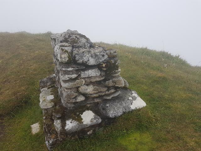 ©painterman61 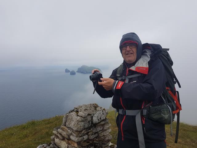 ©painterman61 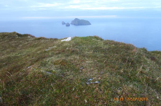 ©jonglew See 1 more in the album. |
![]() 19th May 2023 12:40 by Bridgeman
19th May 2023 12:40 by Bridgeman
FB Number: Not logged Condition: Couldn't find it Score: 2/10
Rough boat trip out from Leverburgh Harris. Once on Hirta, weather deteriorated to a thick wet mist and a cloud base down to 400 feet. Visibility 20 yards. A place not to linger today.
![]() Conachair (rivet) ©Bridgeman
Conachair (rivet) ©Bridgeman
![]() 19th Sep 2021 13:20 by Thomas David Whitaker
19th Sep 2021 13:20 by Thomas David Whitaker
FB Number: Not logged Condition: Not Logged Score: 9/10
No rivet in sight but to be honest I didn't care less. What a magical place to be on a wonderful sunny day with great views across the sea to Boreray and the Stacs and the thought of being on top of the highest point of the remotest British Isle was a bit special.
![]() 20th Jul 2018 12:23 by painterman61
20th Jul 2018 12:23 by painterman61
FB Number: Not logged Condition: Couldn't find it Score: 9/10
Mist clearing great view to the stacks sea ocean all around nothing found
![]() misty station ©painterman61
misty station ©painterman61![]() the mist clears ©painterman61
the mist clears ©painterman61
![]() 17th Sep 2017 19:33 by jonglew
17th Sep 2017 19:33 by jonglew
FB Number: Not logged Condition: Couldn't find it Score: 7/10
GR indicates a small mound approx 10m SE of the truncated pillar thingy. Possible a concrete block now grassed over. Would need to prod the ground and dig - maybe wardens not keen on that.
![]() Somehere round here TP7890©jonglew
Somehere round here TP7890©jonglew
![]() 20th May 2017 13:00 by arranc
20th May 2017 13:00 by arranc
Gridref: NA 10000 00200 FB Number: Not logged Condition: Couldn't find it Score: 9/10
![]() 7th Sep 2012 13:20 by sky high boys
7th Sep 2012 13:20 by sky high boys
FB Number: Not logged Condition: Possibly missing Score: 9/10
Searched the pillar pretty thoroughly and no sign of. Nor on the sizeable stones a few metres North. Maybe it used to be on the now destroyed top bit of the sundial? Reasonable spot for lunch anyway! Edit: According to OS the height of 430.072m is to a rivet set in concrete. I'm now thinking this would probably be on the foundation? Dunno what to put conditions as....
![]() 25th May 2012 12:38 by trigging on an island
25th May 2012 12:38 by trigging on an island
FB Number: Not logged Condition: Destroyed Score: 8/10
The rivet was probably once on this squat pillar pictured (sundial?). There doesn't appear to be any other obvious place it could be. Boreray and the Stacs look magnificent from this viewpoint. Eastwards, I couldn't see the hills of Harris or any other intervening islands. I liked it that way anyhow, open ocean in all directions.
![[map]](/img/trig-map.png.php?t=7890&b=2&l=0&)