![[UK map]](/img/locationmap.png)
| OSGB36 trig archive spreadsheet - IW | |||||||||||||
|---|---|---|---|---|---|---|---|---|---|---|---|---|---|
| Trig Name | Original Name | New Name | EASTING | NORTHING | HEIGHT | ORDER | TYPE OF MARK | Computing Date | CLASS OF LEVELLING | Date of Levelling | LEVELLING DATUM | DESTROYED MARK INDICATOR | COMMENTS |
| Rough Crag | NY11/T48 | NY11T048 | 316109.64 | 497755.03 | 319.430 | 3 | BOLT | 01/06/1952 | 2 | 01/06/1952 | N | 0 | HT TO BOLT IN ROCK |
Nearby trigpoints, placenames
There are 8 photos for this trigpoint (view album).
This trigpoint:
Is ranked joint 15386th with 93 other trigs (more).
Has a mean score of 4.73/10 (from 11 logged visits)
Was First logged: 15th Nov 2012
Has never been found intact
Was Last logged: 18th Oct 2020
Of the 11 logged visits,
1 recorded a location
The error was 59996m
You are not logged in. You must login if you wish to log a visit.
Selection of photos for this Bolt.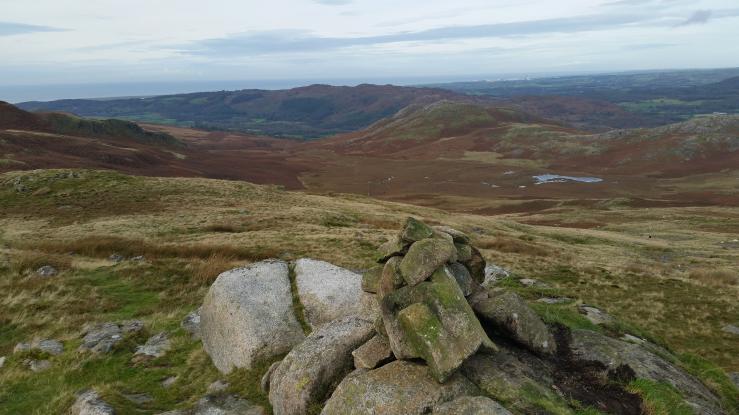 By Dusty 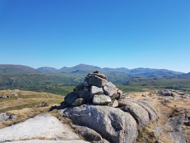 ©painterman61 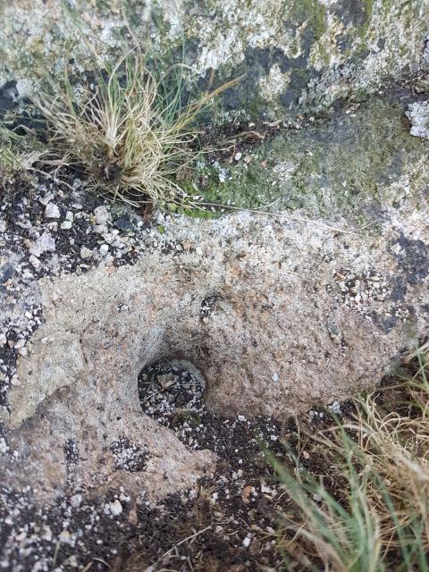 ©painterman61  ©painterman61  By Aye Jimmy See 3 more in the album. |
![]() 18th Oct 2020 10:33 by Morecambe Monkey
18th Oct 2020 10:33 by Morecambe Monkey
FB Number: Not logged Condition: Couldn't find it Score: 5/10
As with others,i couldn't find any sign of it. First of 9 tops on a circuit of Devoke Water.
![]() 14th Oct 2019 12:30 by Dusty
14th Oct 2019 12:30 by Dusty
FB Number: Not logged Condition: Couldn't find it Score: 5/10
Missed the hole found previously by painterman. Now know its gone.
![]() 9th Dec 2018 11:28 by jonglew
9th Dec 2018 11:28 by jonglew
FB Number: Not logged Condition: Couldn't find it Score: 5/10
Given previous logs I declined to dismantle the cairn, hence unfound. It's probably there somewhere, waiting to be found.
![]() 13th Aug 2018 22:19 by mcbiydw2
13th Aug 2018 22:19 by mcbiydw2
FB Number: Not logged Condition: Couldn't find it Score: 5/10
![]() 30th Jun 2018 09:45 by painterman61
30th Jun 2018 09:45 by painterman61
FB Number: Not logged Condition: Possibly missing Score: 5/10
First of the day as it way only a reasonably sized cairn we dismantled it and rebuilt it afterwards after searching underneath.We found what was possibly the mounting drill hole for the bolt under some turf.Great sunny views to devoke water and the fells first of many today.
![]() cairn ©painterman61
cairn ©painterman61![]() looking to devoke water ©painterman61
looking to devoke water ©painterman61![]() possible fixing hole ©painterman61
possible fixing hole ©painterman61![]() cairn ©painterman61
cairn ©painterman61
![]() 19th Jul 2015 07:45 by peregrinus
19th Jul 2015 07:45 by peregrinus
FB Number: Not logged Condition: Possibly missing Score: 5/10
Revisited with couple of nearby p30m summits. Relocated cairn, which to be fair wasn't quite at highest point. Couldn't find bolt though. Now wondering if it was there all the time and now under new cairn! Couldn't spot it though
![]() new cairn but still no sign of bolt
new cairn but still no sign of bolt
![]() 16th Jun 2014 19:18 by Hartryggers
16th Jun 2014 19:18 by Hartryggers
FB Number: Not logged Condition: Couldn't find it Score: 8/10
Parked just off Birker Fell Road at SD 17085 97712 > Seat How (Birker Moor) > Rowantree How > White Pike (Birkby Fell) > Woodend Height > Yoadcastle > Hesk Fell > The Pike > Bigert > Whitfell > Stainton Pike > The Knott (Stainton Fell) > Water Crag > Rough Crag (Birker Moor) > SD 17085 97712. Previous visit 9/6/2008
![]() 25th Feb 2014 11:39 by Aye Jimmy
25th Feb 2014 11:39 by Aye Jimmy
Gridref: SD 16110 37759 FB Number: Not logged Condition: Couldn't find it Score: 4/10
No doubt a nice little summit on a good day, which this wasn't, gale and rain. Rocks appear to be granite. GPS on top of cairn, assuming bolt was underneath it.
![]() Rough Crag Cairn under which may lie a bolt...
Rough Crag Cairn under which may lie a bolt...
![]() 7th Sep 2013 00:00 by rupertal
7th Sep 2013 00:00 by rupertal
FB Number: Not logged Condition: Possibly missing Score: 0/10
![]() 9th Feb 2013 08:49 by PeterKirkwood
9th Feb 2013 08:49 by PeterKirkwood
FB Number: Not logged Condition: Possibly missing Score: 5/10
![]() 15th Nov 2012 18:22 by PeteBoggs
15th Nov 2012 18:22 by PeteBoggs
FB Number: Not logged Condition: Possibly missing Score: 5/10
Followed prow from Birker Fell Road then took path marked by cairn to top.No sign of a bolt at grid ref but there is a fair sized cairn so I guess it could be under that
![]() ©PeteBoggs
©PeteBoggs
![[map]](/img/trig-map.png.php?t=8049&b=2&l=0&)