![[UK map]](/img/locationmap.png)
| OSGB36 trig archive spreadsheet - IW | |||||||||||||
|---|---|---|---|---|---|---|---|---|---|---|---|---|---|
| Trig Name | Original Name | New Name | EASTING | NORTHING | HEIGHT | ORDER | TYPE OF MARK | Computing Date | CLASS OF LEVELLING | Date of Levelling | LEVELLING DATUM | DESTROYED MARK INDICATOR | COMMENTS |
| Rishworth St Car Park | SE22/T273 | SE22T273 | 433043.79 | 421056.01 | 69.500 | 13 | RIVET | 01/06/1989 | 3 | 01/06/1989 | N | 0 | GPS HT NCE 89 |
Nearby trigpoints, placenames
There are 6 photos for this trigpoint (view album).
This trigpoint:
Is ranked joint 23297th with 44 other trigs (more).
Has a mean score of 2.57/10 (from 7 logged visits)
Was First logged: 16th Nov 2013
Has never been found intact
Was Last logged: 22nd Jan 2024
Of the 7 logged visits,
2 recorded a location and of these....
All were within 1000m
The average error was 535m
The closest was 70m
You are not logged in. You must login if you wish to log a visit.
Selection of photos for this Rivet. ©eon  By ted 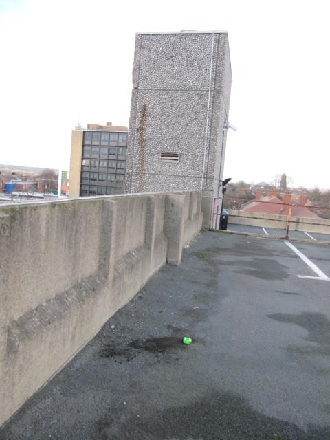 By ted  By CJO See 2 more in the album. |
![]() 22nd Jan 2024 11:00 by Mickandkim
22nd Jan 2024 11:00 by Mickandkim
Gridref: SE 33000 21000 FB Number: Not logged Condition: Destroyed Score: 1/10
Gone
![]() 3rd May 2019 07:23 by eon
3rd May 2019 07:23 by eon
FB Number: Not logged Condition: Destroyed Score: 1/10
(1360) Building demolished a couple of years ago. A street level only car park now occupies the site.
![]() Rishworth Street Car Park. ©eon
Rishworth Street Car Park. ©eon
![]() 15th Apr 2019 23:40 by Ant1974
15th Apr 2019 23:40 by Ant1974
FB Number: Not logged Condition: Possibly missing Score: 5/10
![]() 24th Dec 2014 12:35 by ted
24th Dec 2014 12:35 by ted
FB Number: Not logged Condition: Destroyed Score: 0/10
Obtained the OS station record from the National Archive. The sketch shows the rivet to be placed on the top level of the car park, approx midway between two buttresses and 0.735 metres in from the SW wall. Location checked, nothing found. Suspect it has been lost to resurfacing. Note added August 2017: The car park was demolished on 20 August 2017 http://www.bbc.co.uk/news/uk-england-leeds-40991736
![]() Rishworth Street Car Park site
Rishworth Street Car Park site![]() Rishworth Street Car Park site
Rishworth Street Car Park site
![]() 16th Feb 2014 14:05 by swampysean
16th Feb 2014 14:05 by swampysean
FB Number: Not logged Condition: Couldn't find it Score: 1/10
![]() 16th Feb 2014 14:05 by craftinessa
16th Feb 2014 14:05 by craftinessa
FB Number: Not logged Condition: Couldn't find it Score: 5/10
![]() 16th Nov 2013 08:20 by CJO
16th Nov 2013 08:20 by CJO
Gridref: SE 32043 21056 FB Number: Not logged Condition: Couldn't find it Score: 5/10
SE22 T273 RIVET. GPS points to the top level of the car park in the corner overlooking the police station. The concrete deck has had a layer of tar and bitumen added and no sign of the rivet could be found.
![]() Rishworth Street Car Park
Rishworth Street Car Park ![]() Rishworth Street Car Park TP9378 in background
Rishworth Street Car Park TP9378 in background![]() Rishworth Street Car Park GR is in the top right hand corner
Rishworth Street Car Park GR is in the top right hand corner
![[map]](/img/trig-map.png.php?t=13680&b=2&l=0&)