![[UK map]](/img/locationmap.png)
| OSGB36 trig archive spreadsheet - IW | |||||||||||||
|---|---|---|---|---|---|---|---|---|---|---|---|---|---|
| Trig Name | Original Name | New Name | EASTING | NORTHING | HEIGHT | ORDER | TYPE OF MARK | Computing Date | CLASS OF LEVELLING | Date of Levelling | LEVELLING DATUM | DESTROYED MARK INDICATOR | COMMENTS |
| Port Way | SU31/T346 | SU31T346 | 414403.01 | 133038.01 | 0.000 | 4 | BLOCK | 01/06/1950 | 0 | 0 |
Nearby trigpoints, placenames
There are 2 photos for this trigpoint (view album).
This trigpoint:
Is ranked joint 17204th with 190 other trigs (more).
Has a mean score of 4.33/10 (from 6 logged visits)
Was First logged: 6th Mar 2014
Has never been found intact
Was Last logged: 5th Mar 2022
Of the 6 logged visits,
0 recorded a location
You are not logged in. You must login if you wish to log a visit.
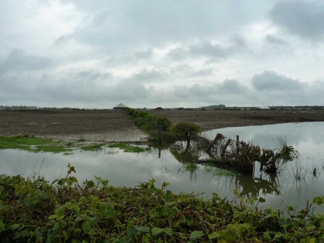
![]() 5th Mar 2022 10:10 by peregrinus
5th Mar 2022 10:10 by peregrinus
FB Number: Not logged Condition: Unknown Score: 5/10
Should be E of pointy roofed building. Not flooded but not accessed
![]() 12th Aug 2019 20:36 by Ant1974
12th Aug 2019 20:36 by Ant1974
FB Number: Not logged Condition: Unknown Score: 5/10
![]() 26th Apr 2014 17:10 by bluebeard
26th Apr 2014 17:10 by bluebeard
FB Number: Not logged Condition: Inaccessible Score: 1/10
![]() 22nd Apr 2014 09:05 by CJO
22nd Apr 2014 09:05 by CJO
FB Number: Not logged Condition: Inaccessible Score: 5/10
In field of pigs - GR looks to be near the feeder shed on the hedge line. No sensible access as field edge was also flooded today.
![]() 15th Mar 2014 06:08 by Trigger
15th Mar 2014 06:08 by Trigger
FB Number: Not logged Condition: Couldn't find it Score: 5/10
![]() 6th Mar 2014 08:37 by jonglew
6th Mar 2014 08:37 by jonglew
FB Number: Not logged Condition: Inaccessible Score: 5/10
Block is on Old Sarum Farm, field currently containing large number of pigs and is being farmed as 'high health' so access only in white suits, boots, disinfected etc. To be honest, looking at the field no-one in their right mind would enter it under any conditions - it's a mud/slurry-fest, the pigs rule the roost! Spoke with farmer/owner (been there 20 years) he says field boundaries shown on OS 1:25k map where block is located are no longer there; in past years he's ploughed and never hit a large lump of concrete near the surface. Assumption is it's been destroyed, but OS record it as extant. Farmer was friendly but could not allow any access so it's inaccessible at present.
![[map]](/img/trig-map.png.php?t=14581&b=2&l=0&)