![[UK map]](/img/locationmap.png)
| OSGB36 trig archive spreadsheet - IW | |||||||||||||
|---|---|---|---|---|---|---|---|---|---|---|---|---|---|
| Trig Name | Original Name | New Name | EASTING | NORTHING | HEIGHT | ORDER | TYPE OF MARK | Computing Date | CLASS OF LEVELLING | Date of Levelling | LEVELLING DATUM | DESTROYED MARK INDICATOR | COMMENTS |
| Croftmorris | NY11/T70 | NY11T070 | 299035.47 | 519477.43 | 0.000 | 3 | BURIED BLK | 01/06/1952 | 0 | 0 |
Nearby trigpoints, placenames
There is 1 photo for this trigpoint (view album).
This trigpoint:
Is ranked joint 8680th with 862 other trigs (more).
Has a mean score of 5.00/10 (from 1 logged visits)
Was First logged: 10th Nov 2019
Has never been found intact
Was Last logged: 10th Nov 2019
Of the 1 logged visits,
0 recorded a location
You are not logged in. You must login if you wish to log a visit.
Selection of photos for this Buried Block.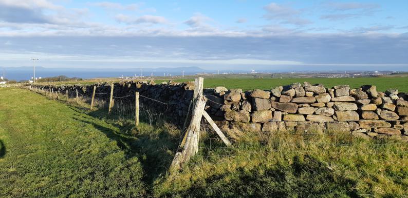 ©jonglew |
![]() 10th Nov 2019 09:22 by jonglew
10th Nov 2019 09:22 by jonglew
FB Number: Not logged Condition: Couldn't find it Score: 5/10
From NX 9880 1960, RoW past farm house, then a short divert. With permission from farmer there's an obvious spot to dig for this one.
![]() Possibly between wall and corner fence post TP16500©jonglew
Possibly between wall and corner fence post TP16500©jonglew
![[map]](/img/trig-map.png.php?t=16500&b=2&l=0&)