![[UK map]](/img/locationmap.png)
| OSGB36 trig archive spreadsheet - IW | |||||||||||||
|---|---|---|---|---|---|---|---|---|---|---|---|---|---|
| Trig Name | Original Name | New Name | EASTING | NORTHING | HEIGHT | ORDER | TYPE OF MARK | Computing Date | CLASS OF LEVELLING | Date of Levelling | LEVELLING DATUM | DESTROYED MARK INDICATOR | COMMENTS |
| Severalls | SU59/T56 | SU59T056 | 460351.35 | 191080.72 | 0.000 | 3 | BLOCK | 01/06/1951 | 0 | 0 |
Nearby trigpoints, placenames
There are 14 photos for this trigpoint (view album).
This trigpoint:
Is ranked joint 15395th with 92 other trigs (more).
Has a mean score of 4.73/10 (from 11 logged visits)
Was First logged: 26th Dec 2011
Was Last logged: 30th Mar 2021
Of the 11 logged visits,
6 recorded a location and of these....
All were within 15m
The average error was 5m
2 were exact
You are not logged in. You must login if you wish to log a visit.
Selection of photos for this Surface Block. ©1473  By thejackrustles  ©jonglew  ©jonglew  By Griefmiester 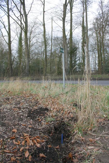 By RogerTempleman See 8 more in the album. |
![]() 30th Mar 2021 16:46 by 1473
30th Mar 2021 16:46 by 1473
Gridref: SU 60366 91078 FB Number: Not logged Condition: Good Score: 5/10
Easily found based on others descriptions in the depression have way from ROW waymarker and fence post. Quick to uncover (first outing for my new trig trowel), good condition. Slightly recovered.
![]() Uncovered Surface Block ©1473
Uncovered Surface Block ©1473
![]() 21st May 2020 11:20 by tomg
21st May 2020 11:20 by tomg
Gridref: SU 60351 91080 FB Number: Not logged Condition: Good Score: 5/10
![]() 23rd Apr 2017 07:30 by thejackrustles
23rd Apr 2017 07:30 by thejackrustles
FB Number: Not logged Condition: Good Score: 5/10
Parked next to it. I think it was Mr U2 who spotted the depression and the block was soon found.
![]() 31st Jan 2016 12:48 by jonglew
31st Jan 2016 12:48 by jonglew
Gridref: SU 60354 91081 FB Number: Not logged Condition: Good Score: 5/10
Parked next to it. Quickly spotted the depression so no need for measuring. Dug round to expose it more fully and left it open. 2" bolt in concrete.
![]() Surface Block - Location TP7904©jonglew
Surface Block - Location TP7904©jonglew![]() Surface Block - Location TP7904©jonglew
Surface Block - Location TP7904©jonglew![]() Surface Block TP7904©jonglew
Surface Block TP7904©jonglew
![]() 17th Jun 2014 17:21 by vw_keychain
17th Jun 2014 17:21 by vw_keychain
FB Number: Not logged Condition: Good Score: 5/10
Easily found following others descriptions of the location. Block is in a small dug out hollow approximately half way between the footpath sign and the right-hand gatepost.
![]() 19th Aug 2013 17:34 by jochta
19th Aug 2013 17:34 by jochta
FB Number: Not logged Condition: Good Score: 5/10
Easily found near the footpath sign neatly flagged by a sapling. It's in a little pit as excavated before.
![]() 8th Aug 2013 19:53 by Griefmiester
8th Aug 2013 19:53 by Griefmiester
Gridref: SU 60352 91084 FB Number: Not logged Condition: Good Score: 3/10
Easily located at road side by footpath, look for the dip in the ground to the right of the footpath! (or for more precise directions look at dal's log :)) - all in good condition large brass surface block.
![]() Surface Block and Bolt
Surface Block and Bolt ![]() GPS Data
GPS Data
![]() 19th Jun 2013 17:10 by peregrinus
19th Jun 2013 17:10 by peregrinus
FB Number: Not logged Condition: Good Score: 3/10
2" bolt in block. My pacing (!) suggests 3m from fp sign and 2.8 from N gate post. Anyway it's just N of the grass path, in leaf litter, in direct line between sign and gate post. Apologies for re excavating dal's holes!
![]() 24th Feb 2012 16:16 by RogerTempleman
24th Feb 2012 16:16 by RogerTempleman
Gridref: SU 60353 91092 FB Number: Not logged Condition: Good Score: 6/10
Easily found thanks to David Lever's measurements: to be clear the bolt is between the footpath sign and the gatepost. I removed the sappling to expose more of the block.
![]() 27th Jan 2012 07:26 by Trigger
27th Jan 2012 07:26 by Trigger
FB Number: Not logged Condition: Good Score: 5/10
![]() 26th Dec 2011 14:50 by dal
26th Dec 2011 14:50 by dal
Gridref: SU 60351 91080 FB Number: Not logged Condition: Good Score: 5/10
Station SU59/T056. Block. In the scrubby verge on the W side of the Shillingford to Wallingford road, by the start of a FP across the fields. I measured the Bolt as being 3.1 m from the northerly gatepost and 3.5m from the FP sign. Spade job. To begin with I found a solid surface, which I think is the buried drive into the field, but the concrete was not really OS quality. Then I tried to the N of this and found the block with the bolt almost under a sapling, about 20cm below the surface. I left it clear, but I guess it will become re-buried. Not a bad location, with good views to the W to the Ridgeway from the adjacent field.
![]() The Bolt
The Bolt ![]() The location With the sapling above
The location With the sapling above![]() The block and the road Later photograph (8/1/12).
The block and the road Later photograph (8/1/12).
![[map]](/img/trig-map.png.php?t=7904&b=2&l=0&)