![[UK map]](/img/locationmap.png)
| OSGB36 trig archive spreadsheet - IW | |||||||||||||
|---|---|---|---|---|---|---|---|---|---|---|---|---|---|
| Trig Name | Original Name | New Name | EASTING | NORTHING | HEIGHT | ORDER | TYPE OF MARK | Computing Date | CLASS OF LEVELLING | Date of Levelling | LEVELLING DATUM | DESTROYED MARK INDICATOR | COMMENTS |
| Broughton Moor | NY11/3 | NY11S003 | 305045.56 | 533029.01 | 129.265 | 2 | PILLAR | 01/06/1952 | 1 | 01/06/1965 | N | 1 | Destroyed 01/92 |
Nearby trigpoints, placenames
There are 11 photos for this trigpoint (view album).
This trigpoint:
Is ranked joint 20540th with 24 other trigs (more).
Has a mean score of 3.80/10 (from 25 logged visits)
Was First logged: 30th Dec 1980
Was Last found intact: 30th Dec 1980
Was Last logged: 21st May 2023
Of the 25 logged visits,
5 recorded a location and of these....
All were within 54m
The average error was 21m
3 were exact
You are not logged in. You must login if you wish to log a visit.
Selection of photos for this Pillar. ©Mark-UKUS  ©jonglew  ©Moacky 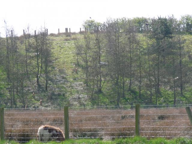 ©Border Peat  By clochandighter 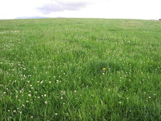 By Hartryggers  By iainmac See 4 more in the album. |
![]() 21st May 2023 17:09 by Mark-UKUS
21st May 2023 17:09 by Mark-UKUS
FB Number: Not logged Condition: Destroyed Score: 6/10
Parked up by the FP and walked up through the small wood to the open field. Made sure I covered most of the high ground to get a good feeling for the siting of the pillar. The TUMP height is given as 132m but the OS shows 129m at the top. Regardless, by wandering around I guess I did enough to log it.
![]() ©Mark-UKUS
©Mark-UKUS
![]() 20th Feb 2023 14:48 by A1Mushroom
20th Feb 2023 14:48 by A1Mushroom
FB Number: Not logged Condition: Destroyed Score: 5/10
Parked in the village and followed the ROW to the field which is just a muddy mess. The ROW sign has now disappeared from the road side.
![]() 12th Feb 2023 12:30 by Mickandkim
12th Feb 2023 12:30 by Mickandkim
Gridref: NY 05000 33000 FB Number: S5658 Condition: Destroyed Score: 1/10
Gone
![]() 24th May 2021 16:13 by vegibagger
24th May 2021 16:13 by vegibagger
FB Number: S5658 Condition: Destroyed Score: 5/10
ROW from goad to the north... Big grassy field that used to have a trig S5658... deceased apparently in 01/92 though I can't see any reason why.... It would've been the 88th birthday trig on my ex Michelle's Birthday Trig Walk of Life. She won't be shedding any years!!
![]() 13th Aug 2018 21:49 by mcbiydw2
13th Aug 2018 21:49 by mcbiydw2
FB Number: Not logged Condition: Not Logged Score: 5/10
![]() 29th Jun 2018 00:00 by Bramley
29th Jun 2018 00:00 by Bramley
FB Number: Not logged Condition: Destroyed Score: 2/10
![]() 3rd May 2018 00:00 by Ronaldo333
3rd May 2018 00:00 by Ronaldo333
FB Number: Not logged Condition: Not Logged Score: 5/10
![]() 14th Dec 2017 16:00 by jonglew
14th Dec 2017 16:00 by jonglew
FB Number: Not logged Condition: Destroyed Score: 4/10
Large pasture, looks like open access for dog walkers. OS records this destroyed January 1992.
![]() The field a short while after sunset TP1695©jonglew
The field a short while after sunset TP1695©jonglew
![]() 30th May 2017 00:00 by rupertal
30th May 2017 00:00 by rupertal
FB Number: Not logged Condition: Destroyed Score: 5/10
Tump bagging, no trig
![]() 1st Apr 2016 18:00 by Moacky
1st Apr 2016 18:00 by Moacky
FB Number: Not logged Condition: Destroyed Score: 5/10
Why am I standing here, in the wind and the rain? The GPS says I am within 2ft of the trig. The reality is different!
![]() Missing a trig ..... ©Moacky
Missing a trig ..... ©Moacky
![]() 23rd Jun 2015 13:42 by peebs
23rd Jun 2015 13:42 by peebs
FB Number: Not logged Condition: Not Logged Score: 5/10
Lovely meadow
![]() 19th Sep 2014 10:30 by amblerbob
19th Sep 2014 10:30 by amblerbob
FB Number: Not logged Condition: Destroyed Score: 5/10
Whilst bagging nearby hill summit (!). Plenty of sheep about.
![]() 21st Jul 2012 16:10 by CJO
21st Jul 2012 16:10 by CJO
FB Number: Not logged Condition: Destroyed Score: 4/10
looks like reclaimmed land from opencast or quarry workings
![]() 9th Apr 2011 14:26 by Border Peat
9th Apr 2011 14:26 by Border Peat
Gridref: NY 05046 33029 FB Number: Not logged Condition: Destroyed Score: 6/10
![]() Not enough time to search all field boundries S5658©Border Peat
Not enough time to search all field boundries S5658©Border Peat
![]() 3rd Mar 2011 21:54 by PeteBoggs
3rd Mar 2011 21:54 by PeteBoggs
FB Number: Not logged Condition: Destroyed Score: 2/10
Not a sign of a trig
![]() 27th Jan 2011 14:52 by Marramintar
27th Jan 2011 14:52 by Marramintar
Gridref: NY 05000 33000 FB Number: Not logged Condition: Destroyed Score: 1/10
No sign at all that the trig was ever there :-(
![]() 25th Jul 2009 13:14 by coinea
25th Jul 2009 13:14 by coinea
FB Number: Not logged Condition: Destroyed Score: 2/10
![]() 25th Jul 2009 13:13 by clochandighter
25th Jul 2009 13:13 by clochandighter
FB Number: Not logged Condition: Destroyed Score: 3/10
HISTORY: Pillar completed 6th September 1948, no record of cost. Computed as secondary triangulation station NY11/3 within the Workington block during 1952. Flush bracket S5658 was levelled for height in 1965. This station was last maintained by the OS in 1977. The OS state that this pillar was destroyed in January 1992. SITE VISIT: GPS`d my way to exact spot. Still missing. Was S5658. Large smooth empty field. This pillar has apparently been the victim of a bad farmer or from previous quarrying operations now landfilled. Shame as it`s a nice location. Overlooks Criffell.
![]() S5658 - Broughton Moor no more. Criffell in the background.
S5658 - Broughton Moor no more. Criffell in the background.![]() S5658 - Broughton Moor site of & GRP.
S5658 - Broughton Moor site of & GRP.
![]() 2nd Aug 2007 09:59 by chrisbombington
2nd Aug 2007 09:59 by chrisbombington
Gridref: NY 05046 33029 FB Number: Not logged Condition: Destroyed Score: 0/10
Definitely missing
![]() 16th Jun 2007 16:21 by Hartryggers
16th Jun 2007 16:21 by Hartryggers
Gridref: NY 05046 33029 FB Number: Not logged Condition: Destroyed Score: 5/10
Used GPS and walked a 20ft circle round the reference, not a trace.
![]()
![]() 8th Jul 2006 19:00 by rhayader_wanderer
8th Jul 2006 19:00 by rhayader_wanderer
FB Number: Not logged Condition: Destroyed Score: 4/10
Soaking wet grassy field and .... nothing despite still being on the revied explorer map of the area
![]() 15th Mar 2006 12:00 by iainmac
15th Mar 2006 12:00 by iainmac
FB Number: Not logged Condition: Destroyed Score: 0/10
Large grass field with nowhere to hide. Used gps and 10 digit grid ref.
![]()
![]()
![]()
![]() 19th Apr 2003 12:00 by peregrinus
19th Apr 2003 12:00 by peregrinus
FB Number: Not logged Condition: Destroyed Score: 7/10
no trace; pasture; Built 06/09/48, destroyed 01/92, fb S5658. (GRP/OS) - Hill:pasture summit; attractive view
![]() 21st May 2001 11:30 by dugswell2
21st May 2001 11:30 by dugswell2
FB Number: NO FB Condition: Destroyed Score: 3/10
Visited these fields every 2-3 days during FMD to check the suckler cows and calves belonging to Mr Stamper.
![]() 30th Dec 1980 00:00 by RogerTempleman
30th Dec 1980 00:00 by RogerTempleman
FB Number: S5658 Condition: Good Score: 5/10
Plain pillar on base in fenced enclosure in fence dividing two marshy pastures. Evening visit with Ros and 9-month old Laura.
![[map]](/img/trig-map.png.php?t=1695&b=2&l=0&)