![[UK map]](/img/locationmap.png)
| OSGB36 trig archive spreadsheet - IW | |||||||||||||
|---|---|---|---|---|---|---|---|---|---|---|---|---|---|
| Trig Name | Original Name | New Name | EASTING | NORTHING | HEIGHT | ORDER | TYPE OF MARK | Computing Date | CLASS OF LEVELLING | Date of Levelling | LEVELLING DATUM | DESTROYED MARK INDICATOR | COMMENTS |
| Dour Hill | NT72/T27 | NT72T027 | 379561.90 | 602298.46 | 415.137 | 3 | PILLAR | 01/06/1957 | 2 | 01/06/1958 | N | 0 |
Nearby trigpoints, placenames
There are 23 photos for this trigpoint (view album).
This trigpoint:
Is ranked joint 1132nd with 18 other trigs (more).
Has a mean score of 6.80/10 (from 20 logged visits)
Was First logged: 22nd Jul 2002
Was Last found intact: 11th Aug 2023
Was Last logged: 13th Aug 2023
Of the 20 logged visits,
6 recorded a location and of these....
All were within 115m
The average error was 40m
The closest was 2m
You are not logged in. You must login if you wish to log a visit.
Selection of photos for this Pillar. ©jonglew  ©jonglew  ©jonglew  By Walker Dan  By NJM 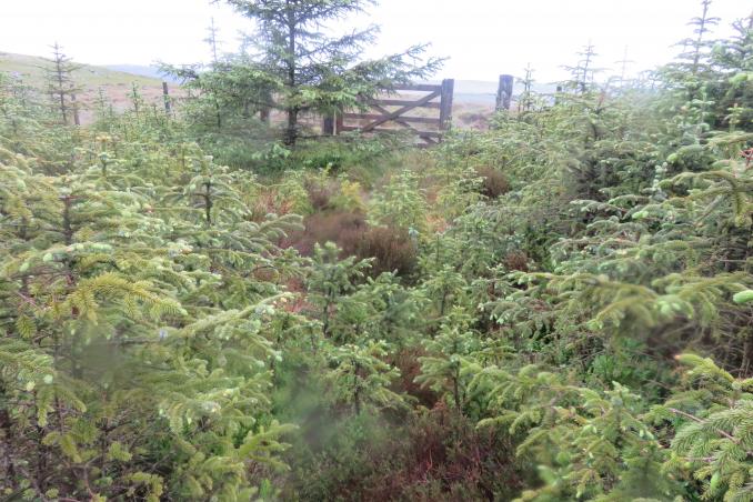 By beckroad See 17 more in the album. |
![]() 13th Aug 2023 00:00 by Llondon
13th Aug 2023 00:00 by Llondon
FB Number: Not logged Condition: Not Logged Score: 5/10
![]() 11th Aug 2023 13:36 by jonglew
11th Aug 2023 13:36 by jonglew
Gridref: NT 79562 02300 FB Number: S7697 Condition: Good Score: 7/10
Parked to WNW on Cottonshope Rd (NT 7827 0293). Took mapped RoW east to cross Cottonshope Burn and proceed up through dense bracken on a narrow track, not easy to find the start; track keeps going eastward up the hill, then followed fenceline SSE along to the trig. Pillar sits at an angle of the fence; centre cap missing, no plug. RHD side sight hole open, front plug degrading. Extensive panoramic views.
![]() Pillar TP2818©jonglew
Pillar TP2818©jonglew![]() Spider TP2818©jonglew
Spider TP2818©jonglew![]() Flush Bracket TP2818©jonglew
Flush Bracket TP2818©jonglew
![]() 26th Dec 2022 11:45 by Walker Dan
26th Dec 2022 11:45 by Walker Dan
FB Number: S7697 Condition: Good Score: 7/10
Straightforward walk from the A68. Track to gate then quad bike track almost to trig. After some wet weather it was a bit boggy in places but easily stepped over most of it. Cold and windy but a refreshing Boxing Day walk. Nice new coat of white paint as well, someone has been busy around a number of Northumbrian trigs this year.
![]() 10th Sep 2022 12:43 by S1534&Beyond
10th Sep 2022 12:43 by S1534&Beyond
FB Number: S7697 Condition: Slightly damaged Score: 8/10
2nd of 3 today. A retrospective log. My notes state limited parking and a challenging trig as my 1st attempt from the ranges (non firing day) was aborted due to a flooded burn. The bridleway in the woods was barely passable and much damage from Storm Arwen. A 6 1/4 mile walk in total. Trig in the cusp of the danger area. Spider missing.
![]() The trig ©S1534&Beyond
The trig ©S1534&Beyond
![]() 17th Apr 2022 00:00 by carolje
17th Apr 2022 00:00 by carolje
FB Number: Not logged Condition: Good Score: 5/10
![]() 30th Apr 2021 15:00 by slateloose
30th Apr 2021 15:00 by slateloose
Gridref: NT 79500 02200 FB Number: S7697 Condition: Good Score: 8/10
Parked in the lay bye on A68 near stony track which heads up towards cairn, walked stony track then followed quad bike track north which runs almost parallel 100/200 yards out from the forest fence line to the trig point. Stunning views of the border hills and the Cheviot hill with a light covering of snow.
![]() 22nd Mar 2021 12:01 by NJM
22nd Mar 2021 12:01 by NJM
FB Number: S7697 Condition: Good Score: 7/10
My second visit, different route, this time pretty much as described by A1M below. A much better route than my first visit which was a real slog across the Ranges from the E on a non firing day. Nothing 'dour' about the hill on a bright sunny spring morning, great 360 views.
![]() View North West Storm's OS Pillar #173
View North West Storm's OS Pillar #173![]() View South
View South ![]() View West
View West
![]() 29th Nov 2020 15:23 by A1Mushroom
29th Nov 2020 15:23 by A1Mushroom
FB Number: S7697 Condition: Good Score: 5/10
Nice big layby on the southbound side, just at the end of the forest. A rocky track runs from the layby to the cairn on the map. A quad track then takes you up the hill to the east of the trig. The heather has been cut back from here to the trig. Instead of walking back along the quad tracks, bog hopping and thigh high wet grasses i made my way down the fence line to 'Kip End' & the 'Long Cairn' where I would pick up one of the logging tracks as they are felling the plantation here. The track to the west of Kip End is the maintained logging road. The track to the south of Kip End is a little over grown and thigh high wet grasses, but the conifers are not so close to make it a pain.
![]() 1st Nov 2020 10:24 by Oldhortus
1st Nov 2020 10:24 by Oldhortus
FB Number: Not logged Condition: Good Score: 7/10
Convenient layby on the A 68 from there due north over rough moorland to the trig. Amazing view of the Northumberland landscape.
![]() 31st May 2019 18:00 by beckroad
31st May 2019 18:00 by beckroad
Gridref: NT 79600 02400 FB Number: S7697 Condition: Good Score: 8/10
Our 2nd of two trigs today. Continuing our walk from Hungry Law we followed the perimeter of the forest park boundary NE to join the Pennine Way at nt777077. Heading south via Houx Hill we descended to the Cottonshope Road, over the burn then uphill towards Dour Hill. This trig is next to a fence. Our return route through the forest didn't happen. Bridleway is overgrown and impassable. A long walk ,partially via the road, ensued. The Forest View Inn is a smashing place for a well deserved real ale at the end of an epic walk.
![]() Dour Hill Looking N.
Dour Hill Looking N.![]() Bridleway entrance at nt797013 Impassable route through the forest. Looking E.
Bridleway entrance at nt797013 Impassable route through the forest. Looking E.
![]() 16th Jul 2017 21:08 by Nick&Rosie
16th Jul 2017 21:08 by Nick&Rosie
FB Number: S7697 Condition: Good Score: 8/10
As it was a 'Non-Firing Day' on the Ranges we headed north from Rochester and parked up along Bellshiel Road and made our way west. It being very late in the day we navigated more by heading directly towards the setting sun, and following a convenient ATV track, which was a mistake as the sun was setting in the north west and not in the WSW direction we needed to head - consequently we ended up much closer to Lamb Crag a good distance north from where we wanted to be. Was very surprised to see in the distance another walker out on the ridge at that time of night (by now it was almost 9pm Sunday evening), and then another, and then a dozen more...it was a platoon of 'our boys' out on an exercise! Beautiful evening, fantastic sunset, great vantage point and good exercise over rough ground - perfect end to the weekend.
![]() View North
View North ![]() View East with Rosie
View East with Rosie ![]() View South
View South ![]() View West
View West
![]() 26th Mar 2017 00:00 by caroleengel
26th Mar 2017 00:00 by caroleengel
Gridref: NT 79563 02294 FB Number: Not logged Condition: Good Score: 5/10
MOD land now extended west and includes the pillar. Used mapped track from south which leads to a good ATV from NT799012 to NT797023. Short stretch heather from here to trig to west
![]() 25th Mar 2017 11:10 by sheepsocks
25th Mar 2017 11:10 by sheepsocks
FB Number: S7697 Condition: Good Score: 6/10
Not sure why this was one of the least visited English trigs as it's only a 45mins, not too strenuous, walk from a main road, has no access problems and the view is open and more interesting than some other Kielder trigs. Maybe it's the name. But now it's had 3 visits in 6 months so it's not so lonely! Walked up through forest track (well-used at first, then overgrown), followed by freestyle up moorland beside fence in glorious sunshine.
![]()
![]()
![]() 28th Dec 2016 10:54 by paulxtr
28th Dec 2016 10:54 by paulxtr
FB Number: S7697 Condition: Good Score: 7/10
Parked in forest track entrance off A68 directly S of pillar. Walked northwards up the track until it petered out then crossed the fence and up the steep heathery slope to the trig. Another great wide Northumberland view.
![]() Dour Hill ©paulxtr
Dour Hill ©paulxtr
![]() 11th Sep 2016 10:15 by Borderer
11th Sep 2016 10:15 by Borderer
FB Number: S7697 Condition: Good Score: 6/10
Parked at the end of the forest road on the A68 and took the surfaced track to a point west of the pillar then up the steep bank. Managed to keep dry despite early morning rain. Impressive views at the summit and on the route up. Surprising that this is the first logged visit since 2008 considering it's location.
![]() ©Borderer
©Borderer
![]() 16th Apr 2008 14:48 by coinea
16th Apr 2008 14:48 by coinea
Gridref: NT 79562 02293 FB Number: S7697 Condition: Good Score: 8/10
![]() 16th Apr 2008 14:44 by clochandighter
16th Apr 2008 14:44 by clochandighter
Gridref: NT 79559 02292 FB Number: S7697 Condition: Good Score: 8/10
Pillar completed 19th November 1953 costing £17.7s.6d. Computed as tertiary station NT72/T27 in 1957. Levelled in 1958. Last maintained by the OS in November 1986. In 2008, the pillar is still in good condition. Spider centre is open. RHS sight hole open, others plugged. Flush bracket faces 94°, East. Photographed 16/04/2008, GRP.
![]() S7697 - Dour Hill pillar & FB
S7697 - Dour Hill pillar & FB
![]() 8th Apr 2007 15:00 by andyc
8th Apr 2007 15:00 by andyc
FB Number: S7697 Condition: Good Score: 7/10
Lovely day on Easter weekend. Followed bridleway from forest edge on the Cottonshope army road. Lovely drive over the ranges afterwards.
![]() 29th Aug 2004 12:00 by peregrinus
29th Aug 2004 12:00 by peregrinus
FB Number: S7697 Condition: Good Score: 7/10
vgc, no cap or plug, nice heathery summit, wide view - Access:from S: forest tk then exit to open grnd, or cross moorld, scrappy at first
![]() S7697 fb ©peregrinus
S7697 fb ©peregrinus![]() S7697 top ©peregrinus
S7697 top ©peregrinus![]() S7697 trig ©peregrinus
S7697 trig ©peregrinus
![]() 22nd Jul 2002 13:15 by jimmy
22nd Jul 2002 13:15 by jimmy
FB Number: S7697 Condition: Good Score: 7/10
![[map]](/img/trig-map.png.php?t=2818&b=2&l=0&)