![[UK map]](/img/locationmap.png)
| OSGB36 trig archive spreadsheet - IW | |||||||||||||
|---|---|---|---|---|---|---|---|---|---|---|---|---|---|
| Trig Name | Original Name | New Name | EASTING | NORTHING | HEIGHT | ORDER | TYPE OF MARK | Computing Date | CLASS OF LEVELLING | Date of Levelling | LEVELLING DATUM | DESTROYED MARK INDICATOR | COMMENTS |
| Ringstone Edge | SE02/T36 | SE02T036 | 404652.36 | 418600.72 | 0.000 | 3 | BURIED BLK | 01/06/1948 | 0 | 0 |
Nearby trigpoints, placenames
There are 20 photos for this trigpoint (view album).
This trigpoint:
Is ranked joint 21401st with 40 other trigs (more).
Has a mean score of 3.57/10 (from 23 logged visits)
Was First logged: 18th Nov 2006
Has never been found intact
Was Last logged: 27th Sep 2022
Of the 23 logged visits,
5 recorded a location and of these....
All were within 52m
The average error was 31m
1 was exact
You are not logged in. You must login if you wish to log a visit.
Selection of photos for this Pillar. ©eon  ©eon  By Wheresthatpenguin  ©Hands 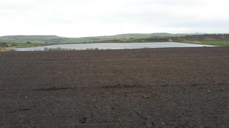 By peregrinus  By John Riley See 14 more in the album. |
![]() 27th Sep 2022 00:00 by Ronaldo333
27th Sep 2022 00:00 by Ronaldo333
FB Number: Not logged Condition: Not Logged Score: 5/10
Whilst visiting Beacon Hill
![]() 22nd May 2022 08:18 by eon
22nd May 2022 08:18 by eon
FB Number: Not logged Condition: Destroyed Score: 1/10
(2537) Saddleworth Road for parking. Pleasant enough walk down to the location. Passing Pigs, goats and sheep as I went. Derelict farm building nearby was of interest. No sign of the pillar, of course. Nor the replacement block. Area simply a flat green field. Pillar history: Build date and cost and when last maintained not present in the archive. FB was S4407. Listed as destroyed November 1960.
![]() Field location ©eon
Field location ©eon![]() Site ©eon
Site ©eon
![]() 9th May 2022 20:25 by Wheresthatpenguin
9th May 2022 20:25 by Wheresthatpenguin
Gridref: SE 04652 18600 FB Number: S4407 Condition: Destroyed Score: 1/10
Gone. Destroyed 10/11/1960. Was located in the area of my photograph. Was replaced by a buried block, which was also later destroyed
![]() 14th Jun 2021 11:55 by Heidi
14th Jun 2021 11:55 by Heidi
Gridref: SE 04600 18600 FB Number: Not logged Condition: Destroyed Score: 3/10
![]() 9th May 2021 12:20 by Mickandkim
9th May 2021 12:20 by Mickandkim
Gridref: SE 04600 18600 FB Number: S4407 Condition: Destroyed Score: 1/10
Gone
![]() 14th Jan 2018 13:50 by Hands
14th Jan 2018 13:50 by Hands
FB Number: Not logged Condition: Destroyed Score: 3/10
Walked west along the surfaced track from Clay House Barn to the derelict farm and climbed the banking to view the site of the destroyed trig, good viewpoint
![]() ©Hands
©Hands
![]() 22nd Oct 2017 15:57 by peregrinus
22nd Oct 2017 15:57 by peregrinus
FB Number: Not logged Condition: Destroyed Score: 5/10
From ENE, empty field. No sign of it lying in old yard, could be buried in small pit area just N of its former location?
![]() trig location in foreground looking S
trig location in foreground looking S![]() 25k map
25k map
![]() 30th Jul 2017 10:45 by SJW1960
30th Jul 2017 10:45 by SJW1960
FB Number: Not logged Condition: Destroyed Score: 5/10
![]() 6th Aug 2016 00:00 by rupertal
6th Aug 2016 00:00 by rupertal
FB Number: Not logged Condition: Destroyed Score: 5/10
![]() 9th Jul 2014 15:00 by dugswell2
9th Jul 2014 15:00 by dugswell2
FB Number: GONE Condition: Destroyed Score: 5/10
Long gone after Pike Law.
![]() 15th Feb 2014 10:52 by CJO
15th Feb 2014 10:52 by CJO
FB Number: Not logged Condition: Destroyed Score: 2/10
Horrific weather. Pillar long gone. Now just an empty field.
![]() 18th Sep 2012 16:54 by Glaslyn
18th Sep 2012 16:54 by Glaslyn
FB Number: Not logged Condition: Destroyed Score: 5/10
No sign.
![]() 12th Sep 2012 16:14 by Keith Stevens
12th Sep 2012 16:14 by Keith Stevens
FB Number: Not logged Condition: Destroyed Score: 4/10
Gone, replaced by block, according to the db. I looked for that - I will add a new page to record that. Strangely, the pillar is not on the OS archive db - just the block. The pillar triangle is on the 1956 and 1968 10K OS maps, but not on the 1964 2.5K map. It went in 1960, according to other logs. The OS archive shows the block established in 1948, but that would have been the pillar build date - all a bit puzzling.
![]() Ringstone Edge site, with reservoir
Ringstone Edge site, with reservoir
![]() 15th Jan 2012 12:00 by painterman61
15th Jan 2012 12:00 by painterman61
FB Number: Not logged Condition: Destroyed Score: 2/10
Its just a green field no signs of owt short walk.
![]() 9th Nov 2011 11:07 by PeteBoggs
9th Nov 2011 11:07 by PeteBoggs
FB Number: Not logged Condition: Destroyed Score: 3/10
Short walk from main road.Cold windy day for visiting a grassy field
![]() ©PeteBoggs
©PeteBoggs![]() ©PeteBoggs
©PeteBoggs
![]() 19th Mar 2011 12:55 by Terry L
19th Mar 2011 12:55 by Terry L
FB Number: Not logged Condition: Destroyed Score: 5/10
Private. Owner unknown. Take RoW along north side as far as ruined buildings. Then ascend track opposite & pass through open gate into huge grassy field. So flat that it's impossible to determine highest point, but grid ref. & old maps indicate pillar stood towards NE end of area enclosed by 320m contour. Disappointing compared with other 'definitely missing' sites.
![]() 15th Sep 2010 14:06 by Triggers
15th Sep 2010 14:06 by Triggers
FB Number: Not logged Condition: Destroyed Score: 1/10
Very hard to know when to stop looking when you know the thing your looking for isn't there anyway. Awful weather today, couldn't see athing
![]() 24th Jul 2010 12:35 by asbown
24th Jul 2010 12:35 by asbown
FB Number: Not logged Condition: Destroyed Score: 6/10
no trig but lovely views in all directions.
![]()
![]() 11th Jul 2010 15:23 by berticusdan
11th Jul 2010 15:23 by berticusdan
FB Number: Not logged Condition: Not Logged Score: 5/10
![]() 25th Jun 2009 11:30 by splash
25th Jun 2009 11:30 by splash
FB Number: Not logged Condition: Destroyed Score: 5/10
Pleasant walk along the track then up on to the ridge.
![]() 15th Mar 2007 14:00 by MAC.HAWK
15th Mar 2007 14:00 by MAC.HAWK
FB Number: Not logged Condition: Destroyed Score: 5/10
It's been gone 46+ years apparently, so why would a middle-aged man tramp miles in howling wind & rain to visit the site?? Don't ask me, I'm the idiot that did it (although in my defence I would add that I did the Greetland 3 first)!! It aint there, as John says you can see why it was there but on todays visit I'd have been happy to be able to see the hills John mentions never mind the trigs!! No cars, on foot!
![]() 17th Dec 2006 12:44 by John Riley
17th Dec 2006 12:44 by John Riley
Gridref: SE 04650 18600 FB Number: Not logged Condition: Destroyed Score: 2/10
Thanks to Rod and ted for this one. Its just a field and sadly not only is there no trig there is also no sign of the block mentioned on bench-marks.org.uk. Views are great, the nearby trig sites of Manshead End, Rishworth Moor and Wholestone Moor are well visible so I guess it was an obvious place for a trig. Sorry ted, I know its not a competition but I have included a photo of another non OS pillar at Booth Wood just for interest.
![]() Ringstone Edge Loking West towards Baitings Reservoir.
Ringstone Edge Loking West towards Baitings Reservoir.![]() Ringstone Edge Looking North.
Ringstone Edge Looking North.![]() Ringstone Edge Lookin SE across the reservoir.
Ringstone Edge Lookin SE across the reservoir.![]() Booth Wood One of another two non-OS pillars, these are across the valley just below the M62.
Booth Wood One of another two non-OS pillars, these are across the valley just below the M62.
![]() 18th Nov 2006 09:20 by ted
18th Nov 2006 09:20 by ted
Gridref: SE 04600 18600 FB Number: Not logged Condition: Destroyed Score: 3/10
Many thanks to Rod Sladen for his research into the OS archives which led to the identification of this site. The station is described on www.bench-marks.org.uk/bm20926 as "Flush Bracket S4407 [PILLAR] Ringstone Edge [SE02/T36] reported destroyed 10/11/1960". This corresponds to the triangulation station symbol depicted on OS 1:25000 South Pennines Edition A dated 1978. It is also shown on OS 102 One_inch (Huddersfield) dated 1954. The pillar is long gone but straightforward access to the site from the footpath to the N via a small disused quarry. Flattish, grassy summit with good views, especially N across the Calder valley. Broken concrete in quarry probably not trig remains.
![]() Ringstone Edge OS South Pennines 1978
Ringstone Edge OS South Pennines 1978![]() Ringstone Edge site
Ringstone Edge site![]() Ringstone Edge site
Ringstone Edge site![]() Ringstone Edge View to hilltop from reservoir
Ringstone Edge View to hilltop from reservoir![]() Booth Wood Nothing to do with Ringstone Edge! This is one of a pair of non-OS pillars at Booth Wood reservoir. M62 in the background.
Booth Wood Nothing to do with Ringstone Edge! This is one of a pair of non-OS pillars at Booth Wood reservoir. M62 in the background.
![[map]](/img/trig-map.png.php?t=7410&b=2&l=0&)