![[UK map]](/img/locationmap.png)
| OSGB36 trig archive spreadsheet - IW | |||||||||||||
|---|---|---|---|---|---|---|---|---|---|---|---|---|---|
| Trig Name | Original Name | New Name | EASTING | NORTHING | HEIGHT | ORDER | TYPE OF MARK | Computing Date | CLASS OF LEVELLING | Date of Levelling | LEVELLING DATUM | DESTROYED MARK INDICATOR | COMMENTS |
| Claise Moire | NG24/H179 | NG24H179 | 168505.26 | 852446.82 | 0.000 | 4 | BOLT | 01/06/1959 | 0 | 0 |
Nearby trigpoints, placenames
There are 2 photos for this trigpoint (view album).
This trigpoint:
Is ranked joint 345th with 17 other trigs (more).
Has a mean score of 9.00/10 (from 1 logged visits)
Was First logged: 5th Apr 2019
Was Last logged: 5th Apr 2019
Of the 1 logged visits,
1 recorded a location
The error was 4m
You are not logged in. You must login if you wish to log a visit.
![]() 5th Apr 2019 16:36 by BigJ
5th Apr 2019 16:36 by BigJ
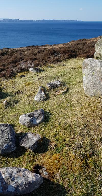
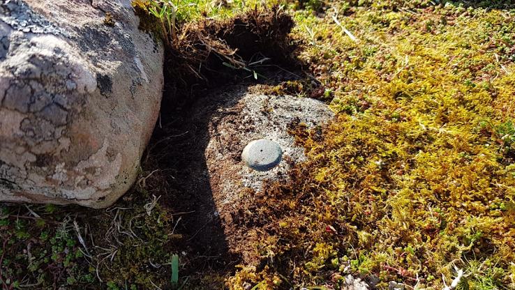
Gridref: NG 68509 52447 FB Number: Not logged Condition: Good Score: 9/10
Parking opposite the marked waterfall. There is a gate through the fences which gives access across a wooden bridge to the hill. There is a large boulder on the summit and the 1 flat bolt is about 2m to the south. Stunning location looking across to Rassay and Skye. With CJ.
![]() ©BigJ
©BigJ![]() ©BigJ
©BigJ
![[map]](/img/trig-map.png.php?t=15336&b=2&l=0&)