![[UK map]](/img/locationmap.png)
| OSGB36 trig archive spreadsheet - IW | |||||||||||||
|---|---|---|---|---|---|---|---|---|---|---|---|---|---|
| Trig Name | Original Name | New Name | EASTING | NORTHING | HEIGHT | ORDER | TYPE OF MARK | Computing Date | CLASS OF LEVELLING | Date of Levelling | LEVELLING DATUM | DESTROYED MARK INDICATOR | COMMENTS |
| Oakfield Plantation | SK58/T84 | SK58T084 | 455785.30 | 369356.63 | 0.000 | 4 | BLOCK | 01/06/1955 | 0 | 0 |
Nearby trigpoints, placenames
There are 4 photos for this trigpoint (view album).
This trigpoint:
Is ranked joint 18426th with 140 other trigs (more).
Has a mean score of 4.00/10 (from 4 logged visits)
Was First logged: 4th Dec 2016
Has never been found intact
Was Last logged: 20th Mar 2024
Of the 4 logged visits,
1 recorded a location
The error was 3m
You are not logged in. You must login if you wish to log a visit.
Selection of photos for this Block. By peregrinus  By peregrinus  ©eon 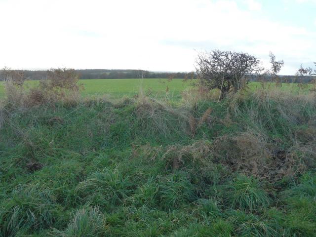 By CJO |
![]() 20th Mar 2024 13:42 by Longest Plague
20th Mar 2024 13:42 by Longest Plague
Gridref: SK 55786 69359 FB Number: Not logged Condition: Not Logged Score: 5/10
Couldn't find the trig, but there was a railway cutting very close the trig location and the area has since been relandscaped and returned back to farmland so I reckon it became lost then in the 1960s when the cutting was infilled, if not to farming later on.
![]() 24th Feb 2024 15:48 by peregrinus
24th Feb 2024 15:48 by peregrinus
FB Number: Not logged Condition: Couldn't find it Score: 5/10
Satellite view indicate hedgeline or SW side. Probing to 45cm in soft ground 2m either side of GR found nothing. Possibly lost to hedge removal or plough, or I missed it
![]() Location looking NW
Location looking NW ![]() Location looking SE
Location looking SE
![]() 16th Apr 2023 11:08 by eon
16th Apr 2023 11:08 by eon
FB Number: Not logged Condition: Couldn't find it Score: 1/10
(2972) Birch Street for parking. Field boundary route not on PRoW, but well used by locals. A few whom I passed today. Block went unfound.
![]() Location ©eon
Location ©eon
![]() 4th Dec 2016 13:14 by CJO
4th Dec 2016 13:14 by CJO
FB Number: Not logged Condition: Couldn't find it Score: 5/10
GR is on old raised hedge line. Very soft probing. Found nothing worth digging for. Odd.
![[map]](/img/trig-map.png.php?t=18907&b=2&l=0&)