![[UK map]](/img/locationmap.png)
| OSGB36 trig archive spreadsheet - IW | |||||||||||||
|---|---|---|---|---|---|---|---|---|---|---|---|---|---|
| Trig Name | Original Name | New Name | EASTING | NORTHING | HEIGHT | ORDER | TYPE OF MARK | Computing Date | CLASS OF LEVELLING | Date of Levelling | LEVELLING DATUM | DESTROYED MARK INDICATOR | COMMENTS |
| Ham Hill | SU31/T223 | SU31T223 | 398374.93 | 91297.58 | 28.797 | 4 | PILLAR | 01/06/1949 | 1 | 01/07/1960 | N | 1 | Dest 06/69 |
Nearby trigpoints, placenames
There are 4 photos for this trigpoint (view album).
This trigpoint:
Is ranked joint 22009th with 5 other trigs (more).
Has a mean score of 3.33/10 (from 15 logged visits)
Was First logged: 9th Dec 2004
Has never been found intact
Was Last logged: 18th Jul 2023
Of the 15 logged visits,
0 recorded a location
You are not logged in. You must login if you wish to log a visit.
Selection of photos for this Pillar. By CJO  By peregrinus  By peregrinus 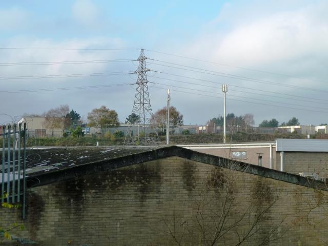 By peregrinus |
![]() 18th Jul 2023 09:31 by asbown
18th Jul 2023 09:31 by asbown
FB Number: Not logged Condition: Destroyed Score: 5/10
Did not try to get in the base.
![]() 18th Jul 2023 09:31 by The reluctant trigger
18th Jul 2023 09:31 by The reluctant trigger
FB Number: Not logged Condition: Destroyed Score: 5/10
![]() 5th Jul 2019 19:45 by dugswell2
5th Jul 2019 19:45 by dugswell2
FB Number: GONE Condition: Destroyed Score: 5/10
Long gone as others have detailed
![]() 12th Feb 2018 16:30 by Trigpoint100
12th Feb 2018 16:30 by Trigpoint100
FB Number: S5114 Condition: Destroyed Score: 2/10
A rare instance of the OS map telling lies ... the 1:25k suggests the land N of this pillar location is access land (which would thus bring you fairly close to the original site). In reality, it is split between an extension of the Marine's base (razor wire topped fence) and a works compound for Rockley Park (complete with five old static caravans). But a nice walk up through the nature reserve with great views over Poole Harbour on a lovely sunny evening. [FB for logging purposes only]. Update 16/02/18 - OS confirmed map is in error and will be corrected in next edition.
![]() 7th Oct 2015 11:39 by jonglew
7th Oct 2015 11:39 by jonglew
FB Number: Not logged Condition: Destroyed Score: 3/10
OS records this destroyed June 1969. Location seems to be within the Royal Marine's Hamworthy base so access a little awkward.
![]() 24th Feb 2015 20:49 by rhayader_wanderer
24th Feb 2015 20:49 by rhayader_wanderer
FB Number: Not logged Condition: Not Logged Score: 5/10
![]() 24th Apr 2014 09:48 by CJO
24th Apr 2014 09:48 by CJO
FB Number: Not logged Condition: Destroyed Score: 5/10
Marine barracks. Listed as destroyed.
![]() Ham Hill view towards security gate
Ham Hill view towards security gate
![]() 13th Nov 2011 12:00 by peregrinus
13th Nov 2011 12:00 by peregrinus
FB Number: Not logged Condition: Destroyed Score: 3/10
Destroyed 06/69 according to OS trig archive. I settled for a couple of distant views, plus a couple of aerial shots. Interesting to compare Google and Bing - has the summit area been cleared recently?
![]() Aerial view (Bing)
Aerial view (Bing) ![]() Site viewed from E
Site viewed from E ![]() Aerial view (GE)
Aerial view (GE)
![]() 6th Nov 2010 13:05 by Glaslyn
6th Nov 2010 13:05 by Glaslyn
FB Number: Not logged Condition: Couldn't find it Score: 5/10
Nothing to add to earlier logs. Access not possible without perission which was refused.
![]() 10th Sep 2010 14:15 by cmb1953
10th Sep 2010 14:15 by cmb1953
FB Number: Not logged Condition: Inaccessible Score: 2/10
Not wishing to test the sense of humour of our security services, I beat a hasty retreat. Not possible to get anywhere near site of TP.
![]() 27th Jan 2010 13:33 by tom
27th Jan 2010 13:33 by tom
FB Number: Not logged Condition: Couldn't find it Score: 1/10
The trig site is within the Royal Marines base in the west of Poole.The base was guarded by armed servicemen and a tall razor wire topped fence. Signs on the fence discourage loitering and photography. In the interests of national security and for fears of my own safety and liberty I decided not to venture any closer. The suburban Napier Road lies to the south of the base. A broad path and stretch of grass separates the camp from a caravan park to the west. From this track some low, grey wooded hills could be seen to the north. To the south of Napier Road the heathland of Ham Common Nature Reserve has some good views over Poole Harbour to the misty Purbeck Hills, but the conditions were probably a bit chilly for much of its noted wildlife to make an appearance.
![]() 20th Aug 2008 12:55 by bluebeard
20th Aug 2008 12:55 by bluebeard
FB Number: Not logged Condition: Couldn't find it Score: 1/10
![]() 18th Mar 2008 13:00 by Trigger
18th Mar 2008 13:00 by Trigger
FB Number: Not logged Condition: Destroyed Score: 5/10
Had a good search around for this today. There is a lot of gorse and brambles in the vicinity but I am pretty certain the pillar has gone. On my next visit I will see if I can arrange to call into Defence Estates and check if they have any knowledge of what happened to it.
![]() 17th Sep 2007 11:45 by PHMB
17th Sep 2007 11:45 by PHMB
FB Number: Not logged Condition: Couldn't find it Score: 0/10
A bit annoying that trigs close to my home are a bit diffucult. Ive only just started logging trig points so I've got more in Wales than Dorset! Anyway this one seems to be in a site once used for refuelling seaplanes in WW2. I'm sure its not going to be far from high gate. This is a securely fenced area and labelled as dangerous. Now editing this as I was looking in the wrong place!Outdoor Leisure 15 shows a different site (SY984907) as a triangulation station to a 7th series Bournemouth map. Correct area is indeed part of Royal Marines camp.
![]() 9th Dec 2004 16:00 by GD8
9th Dec 2004 16:00 by GD8
FB Number: Not logged Condition: Not Logged Score: 3/10
If it's there, it appears to be in the middle of '1 Assault Group - Royal Marines' base! I was severely outnumbered and couldn't think of a way to blag myself in :-(
![[map]](/img/trig-map.png.php?t=3581&b=2&l=0&)