![[UK map]](/img/locationmap.png)
| OSGB36 trig archive spreadsheet - IW | |||||||||||||
|---|---|---|---|---|---|---|---|---|---|---|---|---|---|
| Trig Name | Original Name | New Name | EASTING | NORTHING | HEIGHT | ORDER | TYPE OF MARK | Computing Date | CLASS OF LEVELLING | Date of Levelling | LEVELLING DATUM | DESTROYED MARK INDICATOR | COMMENTS |
| Spartleton | NT86/T23 | NT86T023 | 365323.47 | 665546.36 | 0.000 | 3 | PILLAR | 01/06/1953 | 0 | 0 | REPORTED 28MM OFF PLUMB |
Nearby trigpoints, placenames
There are 46 photos for this trigpoint (view album).
This trigpoint:
Is ranked joint 3113th with 44 other trigs (more).
Has a mean score of 6.12/10 (from 50 logged visits)
Was First logged: 15th Apr 1991
Was Last found intact: 1st May 2024
Was Last logged: 11th May 2024
Of the 50 logged visits,
12 recorded a location and of these....
All were within 51m
The average error was 9m
The closest was 1m
You are not logged in. You must login if you wish to log a visit.
Selection of photos for this Pillar. By Ruarimac23  ©ANDYBUG&LADYBIRD  ©ANDYBUG&LADYBIRD  By rococo1805  By NJM  ©fasgadh  By Moira293 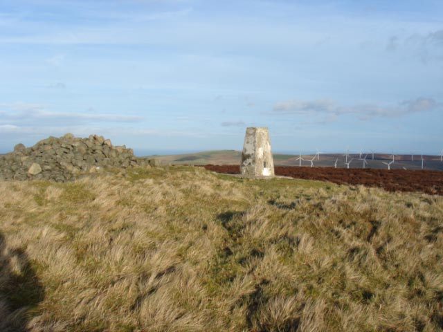 By andyc See 38 more in the album. |
![]() 11th May 2024 19:00 by Dubvine
11th May 2024 19:00 by Dubvine
FB Number: Not logged Condition: Not Logged Score: 5/10
![]() 1st May 2024 05:16 by MileswithRiles
1st May 2024 05:16 by MileswithRiles
FB Number: Not logged Condition: Good Score: 7/10
![]() 15th Jan 2024 12:08 by Ruarimac23
15th Jan 2024 12:08 by Ruarimac23
FB Number: Not logged Condition: Not Logged Score: 5/10
![]()
![]() 10th Sep 2023 13:00 by ANDYBUG&LADYBIRD
10th Sep 2023 13:00 by ANDYBUG&LADYBIRD
FB Number: S7141 Condition: Good Score: 7/10
Lovely walk to this one on a very hot day while staying in the area
![]() ©ANDYBUG&LADYBIRD
©ANDYBUG&LADYBIRD![]() ©ANDYBUG&LADYBIRD
©ANDYBUG&LADYBIRD
![]() 4th Jun 2023 15:03 by rococo1805
4th Jun 2023 15:03 by rococo1805
FB Number: S7141 Condition: Good Score: 5/10
Number 100! Had big ideas for number 100 but timing and other stuff to do in the area meant Spartleton would be chosen. Excellent choice. Very warm afternoon, peaceful and great views. Followed path around left hand side of the hill then descended via the remains of Gamelshiel Castle. Finished off with a trip to Duns Co-op for a needed ice cream.
![]()
![]() 13th Jan 2023 11:42 by NJM
13th Jan 2023 11:42 by NJM
Gridref: NT 65325 65553 FB Number: S7141 Condition: Good Score: 9/10
This has been top of my 'To Do' list for absolutely ages, found a great day for it, bright and breezy but great air quality could see far over Fife to the snow clad hills beyond Tayside. Spartleton was as good a viewpoint as I'd imagined, but hadn't taken into account what a lovely, easy walk it would be and a great circular walk to boot. Up from Millknowe via Gamelsheil Castle remains, picking up good track (not on map) which leads to the summit then continues back S to the start at Millknowe - 3.14 miles, 715ft of ascent. Well worth 9 / 10 this one - a great first TP of 2023, and also completes all extant Pillars on OS Landranger 67.
![]() View North
View North ![]() View East Storm's OS Pillar #449
View East Storm's OS Pillar #449![]() View South
View South ![]() View West
View West
![]() 2nd Jan 2023 12:48 by Poppy60
2nd Jan 2023 12:48 by Poppy60
FB Number: Not logged Condition: Not Logged Score: 5/10
![]() 22nd Apr 2022 14:55 by G4VFL
22nd Apr 2022 14:55 by G4VFL
FB Number: S7141 Condition: Good Score: 5/10
SOTA activation GM/SS-182
![]() 24th Mar 2022 10:00 by DanTrig
24th Mar 2022 10:00 by DanTrig
FB Number: Not logged Condition: Good Score: 7/10
Parked in tiny car park by Whiteadder Water causeway, followed trail to not very interesting Gamelshiel Castle and followed contouring path marked on map approaching the summit from track north-west of summit. Returned the same way. Nice views. High cloud but limited hazy views.
![]() 22nd Dec 2020 12:12 by fasgadh
22nd Dec 2020 12:12 by fasgadh
Gridref: NT 65324 65542 FB Number: S7141 Condition: Good Score: 5/10
No nasty notices seen, but there was one still lurking on Newlands Rig. Shame on those exploiting a catastrophe for their own ends. Probably toasting the "deal" now. Circuit from below the Whiteadder dam, bike to the bridge over the Bothwell Water and then up the Caldercleugh and up the hill from there. More or less on the lazy gits' road over Bothwell Hill on return. Superb weather. Pillar in good shape.
![]() Spartleton ©fasgadh
Spartleton ©fasgadh![]() Spartleton ©fasgadh
Spartleton ©fasgadh![]() Spartleton ©fasgadh
Spartleton ©fasgadh
![]() 30th Oct 2020 19:43 by Oldhortus
30th Oct 2020 19:43 by Oldhortus
FB Number: Not logged Condition: Good Score: 5/10
Came up from the SE over Bothwell hill. A lovely walk which I did many years ago. This is retrospective log.
![]() 30th Oct 2020 12:33 by Moira293
30th Oct 2020 12:33 by Moira293
FB Number: S7141 Condition: Good Score: 7/10
Bagged on a circular walk which started from the track up the side of the house along from the parking area east of the reservoir, going up through the grouse butts onto the ridge before joining the track which led up to the trig. Superb views from the trig however I felt a general air of hostility about the place due to the GOML sign at the start of the walk asking us to consider whether our presence there was firstly essential and secondly responsible :-(
![]() Moi posing at the trig
Moi posing at the trig ![]() Trig and summit cairn
Trig and summit cairn ![]() GOML Notice :-(
GOML Notice :-(
![]() 24th Jul 2020 14:51 by Border Peat
24th Jul 2020 14:51 by Border Peat
Gridref: NT 65324 65549 FB Number: S7141 Condition: Slightly damaged Score: 10/10
Great all round views.The Lammermuirs must be a breeding ground for Wind Turbines
![]() ©Border Peat
©Border Peat![]() ©Border Peat
©Border Peat
![]() 4th May 2020 01:03 by Robduk
4th May 2020 01:03 by Robduk
FB Number: Not logged Condition: Not Logged Score: 5/10
![]() 21st Mar 2020 16:00 by allankelly
21st Mar 2020 16:00 by allankelly
FB Number: S7141 Condition: Good Score: 7/10
Surfaced Landrover track all the way up. Weather station nearby, to the west and with a great view down to Whiteadder reservoir.
![]() Dickens enjoyed the walk :) ©allankelly
Dickens enjoyed the walk :) ©allankelly
![]() 11th Oct 2018 11:07 by greenbell
11th Oct 2018 11:07 by greenbell
FB Number: S7141 Condition: Good Score: 7/10
Edges of another storm, a strange moody day large drops of warm rain and shrouded hills. It's a joyous and easy walk from the Adder (more amusing Scottish Water signs warning of the reptilian namesake). Stunning area - the Herring Road, White Fort and then beautiful North Berwick. Back to the castle remains and talk of Reivers.
![]()
![]()
![]()
![]() 9th Sep 2018 00:00 by Llondon
9th Sep 2018 00:00 by Llondon
FB Number: Not logged Condition: Not Logged Score: 5/10
![]() 24th Jun 2018 13:00 by A1Mushroom
24th Jun 2018 13:00 by A1Mushroom
FB Number: S7141 Condition: Good Score: 5/10
Started at the track by Writerspath Burn and followed it up to the entrance to the windfarm where there is a info board. Doubled back to followed a track up to the trig.
![]() 25th Feb 2018 15:24 by coinea
25th Feb 2018 15:24 by coinea
Gridref: NT 65323 65542 FB Number: S7141 Condition: Good Score: 8/10
Route as Jon Glew. Great views although vast numbers of wind turbines visible belonging to Aikangill and Crystal Rig windfarms.
![]() 18th Oct 2017 10:47 by trigging on an island
18th Oct 2017 10:47 by trigging on an island
FB Number: S7141 Condition: Slightly damaged Score: 6/10
Misty at the top but still an enjoyable ascent and an area I'd like to explore more closely some day.
![]() 18th Oct 2017 10:01 by jonglew
18th Oct 2017 10:01 by jonglew
Gridref: NT 65322 65550 FB Number: S7141 Condition: Good Score: 5/10
From the S, path running up SW side Nettles Cleugh then steep direct route over heather and dying bracken. Pillar has several fractures plastered and painted over and with salts leaching out. Original top cap is retained, deeply indented lettering; RHS sight hole open. Cloud down, no views.
![]() Pillar TP6092©jonglew
Pillar TP6092©jonglew![]() Soider TP6092©jonglew
Soider TP6092©jonglew![]() Flush Bracket TP6092©jonglew
Flush Bracket TP6092©jonglew
![]() 17th Oct 2017 15:24 by mntainman
17th Oct 2017 15:24 by mntainman
Gridref: NT 65325 65546 FB Number: BS7141 Condition: Good Score: 5/10
![]() 5th Sep 2017 00:00 by caroleengel
5th Sep 2017 00:00 by caroleengel
Gridref: NT 65322 65542 FB Number: Not logged Condition: Good Score: 5/10
Also a Marilyn summit
![]() 13th Aug 2016 15:32 by NormanW
13th Aug 2016 15:32 by NormanW
FB Number: Not logged Condition: Good Score: 5/10
![]() 2nd Jun 2016 18:00 by Borderer
2nd Jun 2016 18:00 by Borderer
FB Number: S7141 Condition: Good Score: 7/10
I had been eyeing this one for a while and proved easier than I thought. Followed the Herring road from the minor road west of the hill then the stone track (not shown on my Landranger) to the pillar. Impressive views spoiled slightly by the sea of turbines soon to be joined by a new wind farm around the Wester Dod pillar. Pillar in great condition and appears to have received a new white coat by an anonymous visitor since the last log. Well done.
![]() ©Borderer
©Borderer
![]() 2nd May 2015 17:08 by Robert Phillips
2nd May 2015 17:08 by Robert Phillips
FB Number: Not logged Condition: Good Score: 5/10
![]() 19th Mar 2015 15:00 by tim747
19th Mar 2015 15:00 by tim747
FB Number: S7141 Condition: Good Score: 5/10
![]() 21st Jan 2015 14:00 by Mtb Innerwick Stravaiger
21st Jan 2015 14:00 by Mtb Innerwick Stravaiger
FB Number: S7141 Condition: Slightly damaged Score: 8/10
Been up here a good few times & love the scenery, wild camped here at the summit last June, stunning sunset & sunrise.
![]() Spartleton ©Mtb Innerwick Stravaiger
Spartleton ©Mtb Innerwick Stravaiger![]() Spartleton Moontan Bikers View
www.mtbstravaiger73.blogspot.co.uk
Spartleton Moontan Bikers View
www.mtbstravaiger73.blogspot.co.uk
![]() 1st Jan 2014 11:40 by fasgadh
1st Jan 2014 11:40 by fasgadh
Gridref: NT 65324 65542 FB Number: S7141 Condition: Slightly damaged Score: 5/10
Falling to bits at the top surface now. Claggy day which means you cannot see the sodding wind farms. The hill has aquired a road up it since my last visit.
![]() Spartleton ©fasgadh
Spartleton ©fasgadh![]() Spartleton Damaged top.©fasgadh
Spartleton Damaged top.©fasgadh![]() Spartleton ©fasgadh
Spartleton ©fasgadh
![]() 27th Jul 2013 18:15 by blackboot29
27th Jul 2013 18:15 by blackboot29
FB Number: Not logged Condition: Good Score: 5/10
Walk on good paths
![]() 20th May 2012 16:40 by KevP
20th May 2012 16:40 by KevP
FB Number: S7141 Condition: Slightly damaged Score: 8/10
Climbed hill from east where bridge takes rough track over Whiteadder water. I left this track and followed animal tracks up by Writerspath Burn. However, I then found that a vehicle track not shown on the maps now goes all the way to the summit from just below Ling Rig. So a vehicle track now exists from the end of the tarmac road to the summit (and beyond!) The trig is breaking apart, lots of cracks and loads of damage and loose bits on the top face. Looks like it needs glueing together with something. Gave it an 8 as fantastic sunny views (also I sort of liked the wind farm.)
![]() Spartleton trig Top of trig crumbling away.
Spartleton trig Top of trig crumbling away.
![]() 8th Mar 2011 13:00 by sky high boys
8th Mar 2011 13:00 by sky high boys
FB Number: S7141 Condition: Slightly damaged Score: 6/10
What wind farm? Lol. Breezy one up top, scared up many grouse on the way. Damage to top face of trig, spalled surface and corner.
![]() 17th May 2010 12:10 by Leviathan
17th May 2010 12:10 by Leviathan
FB Number: S7141 Condition: Not Logged Score: 5/10
![]() 21st Mar 2010 12:18 by Fester
21st Mar 2010 12:18 by Fester
FB Number: S7141 Condition: Good Score: 7/10
Decent views if you ignore the wind farm..which you can`t..!
![]() 4th Nov 2009 16:28 by Aye Jimmy
4th Nov 2009 16:28 by Aye Jimmy
Gridref: NT 65324 65546 FB Number: S7141 Condition: Good Score: 6/10
Pleasant little hill, shame about the windmills.
![]() Spartleton Arrived there at dusk.
Spartleton Arrived there at dusk. ![]() Spartleton Location and cap.
Spartleton Location and cap. ![]() Spartleton The FB.
Spartleton The FB.
![]() 11th Jul 2009 16:09 by dugswell2
11th Jul 2009 16:09 by dugswell2
FB Number: S7141 Condition: Good Score: 6/10
From the south on dry clear morning with lovely views of Bass Rock.
![]() 11th Apr 2009 13:40 by clochandighter
11th Apr 2009 13:40 by clochandighter
Gridref: NT 65322 65541 FB Number: S7141 Condition: Good Score: 8/10
Second visit. For GPS reading and up to date photographs. SITE VISIT: Pillar in good condition. Spider retains OS centre cap with deep indented letters. Flush bracket faces 174° south. East sighting hole open. Views include Cheviot, Dirrington Great Law, Sayers Law, Scald Law, Allermuir Hill, Arthurs Seat, West Lomond, East Lomond, Largo Law, North Berwick Law, Cocklaw Hill.
![]() S7141 - Spartleton pillar & FB
S7141 - Spartleton pillar & FB
![]() 22nd Nov 2008 12:00 by peregrinus
22nd Nov 2008 12:00 by peregrinus
FB Number: S7141 Condition: Slightly damaged Score: 7/10
Top eroded, sides cracked. Metal cap, deep letters. From W, steep climb then track leads most of way to summit. Largeish cairn. Fine view.
![]() 7th Jan 2007 12:30 by andyc
7th Jan 2007 12:30 by andyc
FB Number: S7141 Condition: Good Score: 10/10
A beautiful crisp January day out. Today really reminded me why I love trig pointing. Spartleton is an excellent day out.
![]() Windfarm
Windfarm ![]() Firth of Forth
Firth of Forth ![]() Flush Bracket
Flush Bracket
![]() 6th Dec 2006 19:48 by stonestreaker
6th Dec 2006 19:48 by stonestreaker
FB Number: S7141 Condition: Good Score: 6/10
I'm Spartleton!...I'm Spartleton!
![]()
![]()
![]() 17th May 2004 09:23 by mm0ant
17th May 2004 09:23 by mm0ant
FB Number: S7141 Condition: Good Score: 8/10
Excellent view and an easy climb from the south east end car park. Took a radio up for some SOTA operation. Nice visit, spent aver two hours up there.
![]() Trig point close up. Clearly showing S7141 on the TP.©mm0ant
Trig point close up. Clearly showing S7141 on the TP.©mm0ant![]() Farmer drifted by and set lite to the ground cover, While we were there! A nice view of smoke and hills!©mm0ant
Farmer drifted by and set lite to the ground cover, While we were there! A nice view of smoke and hills!©mm0ant
![]() 23rd Aug 2003 13:00 by fasgadh
23rd Aug 2003 13:00 by fasgadh
Gridref: NT 65332 65571 FB Number: S7141 Condition: Good Score: 5/10
Wasps everywhere, nest in cairn? Windfarm beng built to the north. Heather in full bloom. Ascent from a picnic west of the hill.
![]() 8th Mar 2003 00:00 by agentmancuso
8th Mar 2003 00:00 by agentmancuso
FB Number: Not logged Condition: Good Score: 5/10
![]() 12th Jan 2002 12:20 by Sandman
12th Jan 2002 12:20 by Sandman
FB Number: Not logged Condition: Not Logged Score: 5/10
![]() 2nd Sep 2000 13:26 by arranc
2nd Sep 2000 13:26 by arranc
Gridref: NT 65300 65500 FB Number: S7141 Condition: Good Score: 5/10
![]() 18th Feb 2000 12:00 by peregrinus
18th Feb 2000 12:00 by peregrinus
FB Number: Not logged Condition: Not Logged Score: 7/10
good steep hill, wide view; Gamelshiel Castle a fragment of stonework only. No trig details noted.
![]() 1st Jan 2000 06:17 by Chalky
1st Jan 2000 06:17 by Chalky
FB Number: Not logged Condition: Not Logged Score: 5/10
![]() 19th Aug 1997 12:00 by iainmac
19th Aug 1997 12:00 by iainmac
FB Number: S7141 Condition: Good Score: 5/10
Small chunk out of top corner.
![]() 5th Jan 1996 13:20 by vegibagger
5th Jan 1996 13:20 by vegibagger
FB Number: S7141 Condition: Good Score: 5/10
Friend Anne says other friend Marjorie wants to come with us. Higher along road toward Spartleton its clear hills in cloud with snow patches. marjorie panics. Won't come on hill and refuses to be left in car while Anne and I scale hill. With good grace but dissappointment Anne agrees to drive M 12 miles back down road where she can get a bus and return for me in an hour. I trudge on up alone
![]() 15th Apr 1991 14:01 by clochandighter
15th Apr 1991 14:01 by clochandighter
FB Number: S7141 Condition: Good Score: 7/10
First visit. To record FB number. The pillar was completed 17th August 1952 costing £16.1s.3d. In 1953 this marker was computed for triangulation as tertiary station NT86/T23 in the Berwick secondary block. Like several others in the area, flush bracket S7141 was never levelled for height. This trig point was last maintained by the OS in July 1989.
![[map]](/img/trig-map.png.php?t=6092&b=2&l=0&)